
Pruszcz | |
|---|---|
Town | |
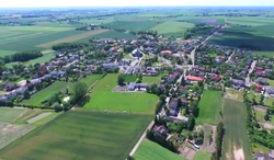 Aerial view | |
 Coat of arms | |
 Pruszcz | |
| Coordinates: 53°19′46″N 18°11′55″E / 53.32944°N 18.19861°E | |
| Country | |
| Voivodeship | Kuyavian-Pomeranian |
| County | Świecie |
| Gmina | Pruszcz |
| Population | |
| • Total | 2,300 |
| Time zone | UTC+1 (CET) |
| • Summer (DST) | UTC+2 (CEST) |
| Vehicle registration | CSW |
| Website | https://www.pruszcz.pl/ |
Pruszcz (Polish pronunciation: [pruʂt͡ʂ]) is a town in Świecie County, Kuyavian-Pomeranian Voivodeship, in north-central Poland.[1] It is the seat of the gmina (administrative district) called Gmina Pruszcz. It lies approximately 19 kilometres (12 mi) south-west of Świecie and 28 km (17 mi) north-east of Bydgoszcz.
The town has a population of 2,300.
YouTube Encyclopedic
-
1/2Views:1 272468
-
Gama SKS UKS Jedynka Starogard Gd. vs MKS MOS Konin - TV Pelplin HD
-
Zakupy na targu w Siemiatyczach
Transcription
History
In 1349, Pruszcz was mentioned as a settlement on the border between the regions of Kuyavia and Pomerania.[2] Pruszcz was a possession of Polish nobility, administratively located in the Świecie County in the Pomeranian Voivodeship of the Kingdom of Poland.[3]
Following the joint German-Soviet invasion of Poland, which started World War II in September 1939, Pruszcz was occupied by Germany until 1945. In 1941, the occupiers carried out expulsions of Poles, who were deported to transit camps in Tczew and Smukała, Bydgoszcz, while their houses were handed over to German colonists as part of the Lebensraum policy.[4]
References
- ^ "Central Statistical Office (GUS) - TERYT (National Register of Territorial Land Apportionment Journal)" (in Polish). 2008-06-01.
- ^ Słownik geograficzny Królestwa Polskiego i innych krajów słowiańskich, Tom IX (in Polish). Warszawa. 1888. p. 104.
{{cite book}}: CS1 maint: location missing publisher (link) - ^ Biskup, Marian; Tomczak, Andrzej (1955). Mapy województwa pomorskiego w drugiej połowie XVI w. (in Polish). Toruń. p. 109.
{{cite book}}: CS1 maint: location missing publisher (link) - ^ Wardzyńska, Maria (2017). Wysiedlenia ludności polskiej z okupowanych ziem polskich włączonych do III Rzeszy w latach 1939-1945 (in Polish). Warszawa: IPN. pp. 93–94. ISBN 978-83-8098-174-4.
| Town and seat |  | |
|---|---|---|
| Villages | ||
This Świecie County location article is a stub. You can help Wikipedia by expanding it. |