Pfäffikon SZ | ||||||||||||||||||||||||||||||||||||||||||||||||||
|---|---|---|---|---|---|---|---|---|---|---|---|---|---|---|---|---|---|---|---|---|---|---|---|---|---|---|---|---|---|---|---|---|---|---|---|---|---|---|---|---|---|---|---|---|---|---|---|---|---|---|
 The station building in 2010 | ||||||||||||||||||||||||||||||||||||||||||||||||||
| General information | ||||||||||||||||||||||||||||||||||||||||||||||||||
| Location | Freienbach Switzerland | |||||||||||||||||||||||||||||||||||||||||||||||||
| Coordinates | 47°12′10.8″N 8°46′41.2″E / 47.203000°N 8.778111°E | |||||||||||||||||||||||||||||||||||||||||||||||||
| Elevation | 412 m (1,352 ft) | |||||||||||||||||||||||||||||||||||||||||||||||||
| Owned by | Swiss Federal Railways | |||||||||||||||||||||||||||||||||||||||||||||||||
| Line(s) | ||||||||||||||||||||||||||||||||||||||||||||||||||
| Distance | 33.10 km (20.57 mi) from Zürich Hauptbahnhof | |||||||||||||||||||||||||||||||||||||||||||||||||
| Platforms | ||||||||||||||||||||||||||||||||||||||||||||||||||
| Tracks | 5 | |||||||||||||||||||||||||||||||||||||||||||||||||
| Train operators | ||||||||||||||||||||||||||||||||||||||||||||||||||
| Connections |
| |||||||||||||||||||||||||||||||||||||||||||||||||
| Passengers | ||||||||||||||||||||||||||||||||||||||||||||||||||
| 2018 | 16,900 per weekday[1] | |||||||||||||||||||||||||||||||||||||||||||||||||
| Services | ||||||||||||||||||||||||||||||||||||||||||||||||||
| ||||||||||||||||||||||||||||||||||||||||||||||||||
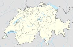
| Location | ||||||||||||||||||||||||||||||||||||||||||||||||||
 | ||||||||||||||||||||||||||||||||||||||||||||||||||
Pfäffikon SZ railway station (German: Bahnhof Pfäffikon SZ) is a junction station serving Pfäffikon, the principal town of the municipality of Freienbach, in the canton of Schwyz (SZ), Switzerland. The station is situated at the northern edge of the town, between the town centre and Lake Zurich.[2][3]
The station forms part of the Lake Zurich left bank railway line, which links Zürich Hauptbahnhof with Ziegelbrücke and Näfels, and is owned and operated by the Swiss Federal Railways (SBB). To the east of the station is the junction for the line to Rapperswil, which crosses Lake Zurich on the Seedamm, whilst to the west is the junction for the line to Arth-Goldau; both these latter being owned and operated by the Südostbahn (SOB).[4][5]
YouTube Encyclopedic
-
1/1Views:348
-
Feuerwerksverkaufsstand für Silvester in Pfäffikon SZ
Transcription
Services
As of the December 2021 timetable change,[update] the following services stop at Pfäffikon SZ:[6]
- InterRegio:
 Aare-Linth: hourly service between Bern and Chur.
- IR Voralpen Express: hourly service between Lucerne and St. Gallen.
- Zürich S-Bahn:
- S2: half-hourly service between Zürich Airport and Ziegelbrücke; on weekends some trains continue to Unterterzen.
- S5: half-hourly service to Zug.
- S8: half-hourly service to Winterthur; individual trains in the late night and early morning operate to Ziegelbrücke.
- S25: hourly service between Zürich Hauptbahnhof and Linthal.
- S40: hourly service between Einsiedeln and Rapperswil.
- Nighttime S-Bahn (only during weekends):[7]
- SN5: hourly service to Knonau (via Rapperswil and Zürich HB).
- SN8: hourly service between Pfäffikon ZH and Lachen (via Zürich HB).
Südostbahn operates the two InterRegio services and the S40; Swiss Federal Railways operates the other Zürich S-Bahn services. During weekends, there are also two nighttime S-Bahn services (SN5 and SN8) offered by ZVV.[8]
Layout and connections
Pfäffikon has two 419-metre (1,375 ft) island platforms with two tracks each (Nos. 2–3; 5–6) and one 299-metre (981 ft) side platform with a single track (No. 7).[9] Adjacent to the station is the Pfäffikon bus terminal. PostAuto Schweiz and AHW Busbetriebe (for the municipality of Freienbach) operate bus services to Ziegelbrücke, Siebnen, Feusisberg, Richterswil and Freienbach.[10]
Gallery
-
-
Station building in 1978
-
Station building, platforms and tracks in 1981
-
Station building in 2011
See also
References
- ^ "Passagierfrequenz". Swiss Federal Railways. 2018. Retrieved 9 January 2023.
- ^ map.geo.admin.ch (Map). Swiss Confederation. Retrieved 7 May 2013.
- ^ Eisenbahnatlas Schweiz. Cologne: Schweers + Wall. 2012. pp. 12–13. ISBN 978-3-89494-130-7.
- ^ "S-Bahn trains, buses and boats" (PDF). ZVV. 9 December 2018. Retrieved 22 September 2019.
- ^ "Liniennetzplan Südostbahn" (PDF). Südostbahn. 9 June 2019. Retrieved 22 September 2019.
- ^ Swiss Federal Railways (12 December 2021). "Abfahrt: Bahnhof Pfäffikon SZ" (PDF) (in German). Retrieved 8 December 2022.
- ^ https://www.zvv.ch/zvv-assets/fahrplan/pdf/nachtnetz.pdf
- ^ https://www.zvv.ch/zvv/en/travelcards-and-tickets/fares/nighttime-network/nacht-fahrplan-und-liniennetz.html
- ^ "Haltestelle: Perronlänge (-körper)". data.sbb.ch. Retrieved 8 December 2022.
- ^ Zürcher Verkehrsverbund (12 December 2021). "Regionalnetz | Regional network" (PDF) (in German). Retrieved 8 December 2022.
Further reading
- Oswald, G; Micher, K (1991). Die Südostbahn, Geschichte einer Privatbahn [The Südostbahn, History of a Private Railway] (in German). Zürich: Orell Füssli Verlag. ISBN 3-280-02048-4.
External links
 Media related to Pfäffikon SZ railway station at Wikimedia Commons
- Pfäffikon SZ railway station – SBB


