
Pan de Azúcar | |
|---|---|
City Municipality | |
 Street view of Pan de Azúcar | |
 Pan de Azúcar | |
| Coordinates: 34°48′0″S 55°13′0″W / 34.80000°S 55.21667°W | |
| Country | |
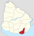
| Department | |
| Founded | 1874 |
| Founded by | Félix de Lizarza |
| Elevation | 79 m (259 ft) |
| Population (2011 Census) | |
| • Total | 6,597 |
| Time zone | UTC -3 |
| Postal code | 20300 |
| Dial plan | +598 443 (+5 digits) |
| Climate | Cfa |
Pan de Azúcar is a city in the southwest of the Maldonado Department in Uruguay. It takes its name from a nearby hill (Cerro Pan de Azúcar, actually located in the neighbouring municipality of Piriápolis), topped by a huge cross.
Pan de Azúcar is also the name of the municipality to which the city belongs. It includes the zones: Pan de Azúcar, Gerona, Kilómetro 110, Nueva Carrara, Puntas de Pan de Azúcar, Laguna del Sauce, Laguna de los Cisnes.
YouTube Encyclopedic
-
1/3Views:1 0513 3641 374
-
Un paseo por Pan de Azucar
-
PINTURAS RUPESTRES EN EL PAN DE AZÚCAR (Uruguay)
-
"Y asi, asi" - Luciano Pereyra en Pan de Azúcar - Uruguay
Transcription
Geography
The city is located at the junction of Route 7 with Route 60, 10 kilometres (6.2 mi) north-northeast of Piriápolis (via Route 37) and about 34 kilometres (21 mi) (via Routa IB) west-northwest from the capital city, Maldonado. The stream Arroyo Pan de Azúcar flows by the southwest limits of the city.
History
It was founded in October 1874 by Félix de Lizarza. Lizarra counted with the help of inhabitants from the city of San Carlos.[citation needed]
Its status was elevated to "Pueblo" (village) by Decree of 20 April 1887,[1] and on 7 September 1961, it was further elevated to "Ciudad" (city) by the Act of Ley N° 12.908.[2]
Population
In 2011, Pan de Azúcar had a population of 6,597.[3] According to the Intendencia Departamnetal de Maldonado, the municipality of Pan de Azúcar has a population of 9,500.[4]

| Year | Population |
|---|---|
| 1908 | 3,409 |
| 1963 | 4,190 |
| 1975 | 5,125 |
| 1985 | 5,513 |
| 1996 | 6,532 |
| 2004 | 7,098 |
| 2011 | 6,597 |
Source: Instituto Nacional de Estadística de Uruguay[1]
Places of worship
- Parish Church of Our Lady of Sorrows (Roman Catholic)
See also
References
- ^ a b "Statistics of urban localities (1908–2004)" (PDF). INE. 2012. Retrieved 8 September 2012.
- ^ "LEY N° 12.908". República Oriental del Uruguay, Poder Legislativo. 1961. Archived from the original on 6 October 2014. Retrieved 8 September 2012.
- ^ "Censos 2011 Cuadros Maldonado". INE. 2012. Retrieved 25 August 2012.
- ^ "Presupuesto-2011-2015". Intendencia Departamnetal de Maldonado. 2012. Archived from the original on 24 April 2011. Retrieved 11 September 2012.
External links
Capital: | ||
| Municipalities |
|  |
| Towns and villages | ||
| Sights | ||
| International | |
|---|---|
| National | |
This article about a place in Maldonado Department is a stub. You can help Wikipedia by expanding it. |