
New Hope, North Carolina | |
|---|---|
 New Hope  New Hope | |
| Coordinates: 35°22′39″N 77°53′32″W / 35.37750°N 77.89222°W | |
| Country | United States |
| State | North Carolina |
| County | Wayne |
| Area | |
| • Total | 2.58 sq mi (6.69 km2) |
| • Land | 2.54 sq mi (6.57 km2) |
| • Water | 0.05 sq mi (0.12 km2) |
| Elevation | 131 ft (40 m) |
| Population (2020) | |
| • Total | 1,588 |
| • Density | 626.43/sq mi (241.87/km2) |
| Time zone | UTC-5 (Eastern (EST)) |
| • Summer (DST) | UTC-4 (EDT) |
| ZIP Codes | |
| Area code(s) | 919 / 984 |
| FIPS code | 37-46650 |
| GNIS feature ID | 2806992[2] |
New Hope is an unincorporated area and census-designated place (CDP) in Wayne County, North Carolina, United States.[2] It was first listed as a CDP in the 2020 census with a population of 1,588.[2]
The CDP is in eastern Wayne County, bordered to the west by the city of Goldsboro, the county seat. It is bordered to the north by Old Mill Branch and West Bear Creek, which flows east to Bear Creek and then south to the Neuse River. It is bordered to the south by the EC Line of the North Carolina Railroad. The main road through the community is East New Hope Road, which leads west 2 miles (3 km) to U.S. Route 13 in Goldsboro and southeast 3 miles (5 km) to Best. The Goldsboro Bypass (U.S. Route 70 Bypass) passes 1 mile (1.6 km) east of New Hope, with access from Exit 364 (Mark Edwards Road).
Demographics
| Census | Pop. | Note | %± |
|---|---|---|---|
| 2020 | 1,588 | — | |
| U.S. Decennial Census[3] 2020[4] | |||
2020 census
| Race / Ethnicity | Pop 2020[4] | % 2020 |
|---|---|---|
| White alone (NH) | 739 | 46.54% |
| Black or African American alone (NH) | 528 | 33.25% |
| Native American or Alaska Native alone (NH) | 11 | 0.69% |
| Asian alone (NH) | 39 | 2.46% |
| Pacific Islander alone (NH) | 1 | 0.06% |
| Some Other Race alone (NH) | 12 | 0.76% |
| Mixed Race/Multi-Racial (NH) | 77 | 4.85% |
| Hispanic or Latino (any race) | 181 | 11.40% |
| Total | 1,588 | 100.00% |
Note: the US Census treats Hispanic/Latino as an ethnic category. This table excludes Latinos from the racial categories and assigns them to a separate category. Hispanics/Latinos can be of any race.
References
- ^ "ArcGIS REST Services Directory". United States Census Bureau. Retrieved September 20, 2022.
- ^ a b c d U.S. Geological Survey Geographic Names Information System: New Hope, Wayne County, North Carolina
- ^ "Decennial Census by Decade". US Census Bureau.
- ^ a b "P2 HISPANIC OR LATINO, AND NOT HISPANIC OR LATINO BY RACE – 2020: DEC Redistricting Data (PL 94-171) – New Hope CDP, North Carolina". United States Census Bureau.
Municipalities and communities of Wayne County, North Carolina, United States | ||
|---|---|---|
| City | 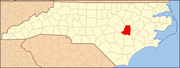 | |
| Towns | ||
| Village | ||
| CDPs | ||
| Other communities | ||
| Footnotes | ‡This populated place also has portions in an adjacent county or counties | |