
Needham, Alabama | |
|---|---|
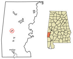 Location of Needham in Choctaw County, Alabama. | |
| Coordinates: 31°59′11″N 88°20′20″W / 31.98639°N 88.33889°W | |
| Country | United States |
| State | Alabama |
| County | Choctaw |
| Area | |
| • Total | 0.57 sq mi (1.48 km2) |
| • Land | 0.57 sq mi (1.48 km2) |
| • Water | 0.00 sq mi (0.00 km2) |
| Elevation | 167 ft (51 m) |
| Population (2020) | |
| • Total | 73 |
| • Density | 127.62/sq mi (49.24/km2) |
| Time zone | UTC-6 (Central (CST)) |
| • Summer (DST) | UTC-5 (CDT) |
| ZIP code | 36915 |
| Area code(s) | 205, 659 |
| FIPS code | 01-53472 |
| GNIS feature ID | 2406970[2] |
Needham is a town in Choctaw County, Alabama, United States. It incorporated in 1981.[3] At the 2020 census, the population was 73.
YouTube Encyclopedic
-
1/3Views:9 915 4562 10966 322
-
Native America before European Colonization
-
How to Choose The Right Home Warranty Company
-
✓Best Chicken Coop Designs & Plans-Ultimate Coop Ideas! How To Build A Chicken Coop-Best DIY Designs
Transcription
Geography
Needham is located near the center of Choctaw County at 31°59'10.817" North, 88°20'19.662" West (31.986338, -88.338795).[4]
According to the U.S. Census Bureau, the town has a total area of 0.58 square miles (1.5 km2), all land.[5]
Demographics
| Census | Pop. | Note | %± |
|---|---|---|---|
| 1990 | 99 | — | |
| 2000 | 97 | −2.0% | |
| 2010 | 94 | −3.1% | |
| 2020 | 73 | −22.3% | |
| U.S. Decennial Census[6] | |||
As of the census[7] of 2000, there were 97 people, 39 households, and 32 families residing in the town. The population density was 169.4 inhabitants per square mile (65.4/km2). There were 46 housing units at an average density of 80.3 per square mile (31.0/km2). The racial makeup of the town was 100.00% White.
There were 39 households, out of which 30.8% had children under the age of 18 living with them, 71.8% were married couples living together, 10.3% had a female householder with no husband present, and 17.9% were non-families. 17.9% of all households were made up of individuals, and 12.8% had someone living alone who was 65 years of age or older. The average household size was 2.49 and the average family size was 2.81.
In the town, the population was spread out, with 20.6% under the age of 18, 4.1% from 18 to 24, 29.9% from 25 to 44, 26.8% from 45 to 64, and 18.6% who were 65 years of age or older. The median age was 42 years. For every 100 females, there were 98.0 males. For every 100 females age 18 and over, there were 92.5 males.
The median income for a household in the town was $38,750, and the median income for a family was $42,083. Males had a median income of $35,417 versus $21,250 for females. The per capita income for the town was $16,764. There were 12.1% of families and 11.6% of the population living below the poverty line, including no under eighteens and 11.1% of those over 64.
References
- ^ "2020 U.S. Gazetteer Files". United States Census Bureau. Retrieved October 29, 2021.
- ^ a b U.S. Geological Survey Geographic Names Information System: Needham, Alabama
- ^ "1990 Census of Population and Housing: Population and housing unit counts. Alabama". 1993.
- ^ "US Gazetteer files: 2010, 2000, and 1990". United States Census Bureau. February 12, 2011. Retrieved April 23, 2011.
- ^ "Geographic Identifiers: 2010 Demographic Profile Data (G001): Needham town, Alabama". U.S. Census Bureau, American Factfinder. Archived from the original on February 12, 2020. Retrieved June 5, 2014.
- ^ "U.S. Decennial Census". Census.gov. Retrieved June 6, 2013.
- ^ "U.S. Census website". United States Census Bureau. Retrieved January 31, 2008.
External links
31°59′11″N 88°20′20″W / 31.986338°N 88.338795°W
Municipalities and communities of Choctaw County, Alabama, United States | ||
|---|---|---|
| Towns | 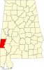 | |
| CDP | ||
| Unincorporated communities | ||
| Footnotes | ‡This populated place also has portions in an adjacent county or counties | |