
This is a list of the National Register of Historic Places listings in Kiowa County, Oklahoma.
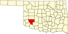
This is intended to be a complete list of the properties and districts on the National Register of Historic Places in Kiowa County, Oklahoma, United States. The locations of National Register properties and districts for which the latitude and longitude coordinates are included below, may be seen in a map.[1]
There are 8 properties and districts listed on the National Register in the county.
This National Park Service list is complete through NPS recent listings posted May 3, 2024.[2]
Current listings
| [3] | Name on the Register[4] | Image | Date listed[5] | Location | City or town | Description |
|---|---|---|---|---|---|---|
| 1 | Camp Radziminski | April 13, 1972 (#72001067) |
Address Restricted | Mountain Park | ||
| 2 | Devil's Canyon | June 20, 1972 (#72001066) |
Along the North Fork of the Red River at the center of a triangle with points at Blair, Lugert, and Warren[6] 34°50′10″N 99°15′20″W / 34.8361°N 99.2556°W | Lugert | ||
| 3 | Downtown Hobart Historic District |  |
March 10, 2005 (#05000130) |
Roughly bounded by Jefferson St., 3rd, Washington, 4th, and the 200 and 500 blocks of S. Main St. 35°01′28″N 99°05′34″W / 35.024444°N 99.092778°W | Hobart | |
| 4 | Hobart City Hall |  |
May 22, 1978 (#78002240) |
Main and 3rd Sts. 35°01′33″N 99°05′33″W / 35.025833°N 99.0925°W | Hobart | |
| 5 | Hobart Public Library |  |
October 31, 1980 (#80003267) |
200 S. Main St. 35°01′34″N 99°05′33″W / 35.026111°N 99.0925°W | Hobart | |
| 6 | Hobart Rock Island Depot |  |
December 7, 1995 (#95001418) |
518 S. Main 35°01′21″N 99°05′31″W / 35.0225°N 99.091944°W | Hobart | |
| 7 | Joyce House | March 19, 2012 (#11000338) |
County Road 1620 EW, 2.5 miles (4.0 km) west of US 183 34°40′09″N 98°59′53″W / 34.669117°N 98.998036°W | Snyder vicinity | ||
| 8 | Kiowa County Courthouse |  |
August 23, 1984 (#84003094) |
Courthouse Square 35°01′30″N 99°05′31″W / 35.025°N 99.091944°W | Hobart |
See also
Wikimedia Commons has media related to National Register of Historic Places in Kiowa County, Oklahoma.
- List of National Historic Landmarks in Oklahoma
- National Register of Historic Places listings in Oklahoma
References
- ^ The latitude and longitude information provided in this table was derived originally from the National Register Information System, which has been found to be fairly accurate for about 99% of listings. Some locations in this table may have been corrected to current GPS standards.
- ^ National Park Service, United States Department of the Interior, "National Register of Historic Places: Weekly List Actions", retrieved May 3, 2024.
- ^ Numbers represent an alphabetical ordering by significant words. Various colorings, defined here, differentiate National Historic Landmarks and historic districts from other NRHP buildings, structures, sites or objects.
- ^ "National Register Information System". National Register of Historic Places. National Park Service. March 13, 2009.
- ^ The eight-digit number below each date is the number assigned to each location in the National Register Information System database, which can be viewed by clicking the number.
- ^ Location derived from its GNIS feature record; the NRIS lists the site as "Address Restricted"
| Topics | |
|---|---|
| Lists by state |
|
| Lists by insular areas | |
| Lists by associated state | |
| Other areas | |
| Related | |
Municipalities and communities of Kiowa County, Oklahoma, United States | ||
|---|---|---|
| City |  | |
| Towns | ||
| Unincorporated communities | ||