
Namhkam
နမ့်ခမ်းမြို့နယ် | |
|---|---|
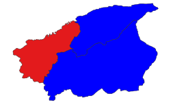 Location in Muse district | |
 Namhkam | |
| Coordinates: 23°50′0″N 97°40′0″E / 23.83333°N 97.66667°E | |
| Country | |
| State | Shan State |
| District | Mu Se District |
| Area | |
| • Total | 466.85 sq mi (1,209.14 km2) |
| Elevation | 2,489 ft (759 m) |
| Highest elevation | 7,741 ft (2,359 m) |
| Population (2019)[2] | 116,744 |
| • Ethnicities | |
| • Religions | Buddhism |
| Time zone | UTC+6:30 (MMT) |
Namhkam Township (also known as Nanhkan Township) is a township of Mu Se District in the Shan State of eastern Myanmar. The principal town is Namhkam, a few miles away from Mu Se.
Inhabitants
A large majority of the people in Namhkam Township are Shan and Kachin with a smaller presence of the Palaung.[3]
Economy
According to a survey conducted in 16 villages, poppy cultivation increased from 812 acres (328 hectares) to 1,535 acres (617 hectares) from the 2006–2007 season to the 2008–2009 season.[4]
Unrest
The Shan State Army-North (SSA-N) and Shan State National Army (SSNA) are active in Namhkam Township.[5] Pansay Militia is one of eight influential militias.[6] Kyaw Myint, head of Pansay militia, was selected as a USDP candidate of Namhkam for Shan State Hluttaw.[7][8]
References
- ^ GoogleEarth
- ^ a b Myanmar Information Management Unit (2019). Namhkan Myone Daethasaingyarachatlatmya နမ့်ခမ်းမြို့နယ် ဒေသဆိုင်ရာအချက်လက်များ [Namkham Township Regional Information] (PDF) (Report). MIMU. Retrieved 8 November 2023.
- ^ Palaung Land
- ^ Poisoned hills page 17
- ^ "Police reinforcements in Nam Kham town". Archived from the original on 3 September 2014. Retrieved 27 January 2015.
- ^ Poisoned Hills page 10
- ^ BurmaNet News, September 25 - 27, 2010
- ^ Stolen Lives


This Shan State location article is a stub. You can help Wikipedia by expanding it. |