
Mueang Uthai Thani
เมืองอุทัยธานี | |
|---|---|
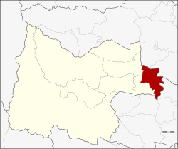 District location in Uthai Thani province | |
| Coordinates: 15°22′46″N 100°1′29″E / 15.37944°N 100.02472°E | |
| Country | Thailand |
| Province | Uthai Thani |
| Area | |
| • Total | 250.1 km2 (96.6 sq mi) |
| Population (2005) | |
| • Total | 52,591 |
| • Density | 210.3/km2 (545/sq mi) |
| Time zone | UTC+7 (ICT) |
| Postal code | 61000 |
| Geocode | 6101 |
Mueang Uthai Thani (Thai: เมืองอุทัยธานี, pronounced [mɯ̄a̯ŋ ʔù.tʰāj tʰāː.nīː]) is the capital district (amphoe mueang) of Uthai Thani province, northern Thailand.[1]
Geography
Neighboring districts are (from the west clockwise) Nong Khayang and Thap Than, of Uthai Thani Province; Krok Phra and Phayuha Khiri of Nakhon Sawan province; Manorom and Wat Sing of Chai Nat province.
Administration
The district is divided into 14 sub-districts (tambons), which are further subdivided into 86 villages (mubans).[2] The town (thesaban mueang) Uthai Thani covers the whole tambon Uthai Mai. There are a further eight tambon administrative organizations (TAO).
| No. | Name | Thai name | Villages | Pop. | |
|---|---|---|---|---|---|
| 1. | Uthai Mai | อุทัยใหม่ | - | 17,510 | |
| 2. | Nam Suem | น้ำซึม | 7 | 6,148 | |
| 3. | Sakae Krang | สะแกกรัง | 8 | 4,773 | |
| 4. | Don Khwang | ดอนขวาง | 7 | 3,197 | |
| 5. | Hat Thanong | หาดทนง | 6 | 2,036 | |
| 6. | Ko Thepho | เกาะเทโพ | 6 | 2,480 | |
| 7. | Tha Sung | ท่าซุง | 8 | 3,951 | |
| 8. | Nong Kae | หนองแก | 6 | 2,059 | |
| 9. | Non Lek | โนนเหล็ก | 6 | 1,406 | |
| 10. | Nong Tao | หนองเต่า | 6 | 1,768 | |
| 11. | Nong Phai Baen | หนองไผ่แบน | 6 | 2,356 | |
| 12. | Nong Phang Kha | หนองพังค่า | 6 | 1,654 | |
| 13. | Thung Yai | ทุ่งใหญ่ | 5 | 909 | |
| 14. | Noen Chaeng | เนินแจง | 9 | 2,344 |
References
- ^ "Uthai Thani Map: Detailed maps for the city of Uthai Thani - ViaMichelin". www.viamichelin.co.uk. Retrieved 25 July 2020.
- ^ "Mueang Uthai Thani (District, Uthai Thani, Thailand) - Population Statistics, Charts, Map and Location". www.citypopulation.de. Retrieved 25 July 2020.
This Uthai Thani Province location article is a stub. You can help Wikipedia by expanding it. |