
Huai Khot
ห้วยคต | |
|---|---|
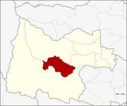 District location in Uthai Thani province | |
| Coordinates: 15°17′29″N 99°37′0″E / 15.29139°N 99.61667°E | |
| Country | Thailand |
| Province | Uthai Thani |
| Seat | Huai Khot |
| Area | |
| • Total | 424.17 km2 (163.77 sq mi) |
| Population (2005) | |
| • Total | 19,547 |
| • Density | 46.1/km2 (119/sq mi) |
| Time zone | UTC+7 (ICT) |
| Postal code | 61170 |
| Geocode | 6108 |
Huai Khot (Thai: ห้วยคต, pronounced [hûa̯j kʰót]) is a district (amphoe) in the central part of Uthai Thani province, northern Thailand.
YouTube Encyclopedic
-
1/3Views:14 9901 276836
-
[ENG SUB]: WAT HUAY MONGKOL | วัดห้วยมงคล | เที่ยววัดดังแห่งหัวหิน ขอโชคลาภไอ้ไข่ กราบไหว้หลวงปู่ทวด
-
Wat Chantaram - Uthai Thani
-
絕美廢棄採石場 | Grand Canyon Chonburi Bang Saen 海灘 vlog | 李潔 我在曼生活
Transcription
History
Tambons Huai Khot, Suk Ruethai and Thong Lang were separated from Ban Rai district and formed Huai Khot minor district (king amphoe) on 1 August 1984.[1] It was upgraded to a full district on 3 November 1993.[2]
Geography
Neighbouring districts are (from the south clockwise) Ban Rai, Lan Sak and Nong Chang of Uthai Thani Province.
Administration
The district is divided into three sub-districts (tambons), which are further subdivided into 31 villages (mubans). There are no municipal (thesaban) areas. There are a further three tambon administrative organizations (TAO).[citation needed]
| No. | Name | Thai name | Villages | Pop. | |
|---|---|---|---|---|---|
| 1. | Suk Ruethai | สุขฤทัย | 13 | 6,564 | |
| 2. | Thong Lang | ทองหลาง | 8 | 7,043 | |
| 3. | Huai Khot | ห้วยคต | 10 | 5,940 |
References
- ^ ประกาศกระทรวงมหาดไทย เรื่อง แบ่งท้องที่อำเภอบ้านไร่ จังหวัดอุทัยธานี ตั้งเป็นกิ่งอำเภอห้วยคต (PDF). Royal Gazette (in Thai). 101 (110 ง): 2766. 21 August 1984. Archived from the original (PDF) on 4 May 2012.
- ^ พระราชกฤษฎีกาตั้งอำเภอลำทับ อำเภอร่องคำ อำเภอเวียงแหง อำเภอนาโยง อำเภอแก้งสนามนาง อำเภอโนนแดง อำเภอบ้านหลวง อำเภอกะพ้อ อำเภอศรีบรรพต อำเภอแก่งกระจาน อำเภอหนองสูง อำเภอสบเมย อำเภอเมยวดี อำเภอโคกเจริญ อำเภอทุ่งหัวช้าง อำเภอผาขาว อำเภอวังหิน อำเภอดอนพุด อำเภอบึงโขงหลง และอำเภอห้วยคต พ.ศ. ๒๕๓๖ (PDF). Royal Gazette (in Thai). 110 (179 ก special): 1–3. 3 November 1993. Archived from the original (PDF) on 24 February 2012.
External links
- https://web.archive.org/web/20070731173847/http://www.huaikhot.net/ Website of district (Thai)
- amphoe.com
This Uthai Thani Province location article is a stub. You can help Wikipedia by expanding it. |