
| Moyo River Brang Moyo, Sungai Brang Moyo, Brang Mojo, Mojo River | |
|---|---|
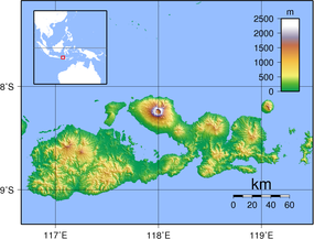 Location of the mouth  Moyo River (Indonesia) | |
| Location | |
| Country | Indonesia |
| Physical characteristics | |
| Source | |
| • location | Sumbawa |
| Mouth | |
• location | West Nusa Tenggara |
The Moyo River is a river of Sumbawa, West Nusa Tenggara province, Indonesia, about 1200 km east of capital Jakarta.[1][2]
Geography
The river flows along the northwestern area of Sumbawa with predominantly tropical savanna climate (designated as As in the Köppen-Geiger climate classification).[3] The annual average temperature in the area is 26 °C. The warmest month is October, when the average temperature is around 30 °C, and the coldest is February, at 24 °C.[4] The average annual rainfall is 1456 mm.. The wettest month is January, with an average of 294 mm rainfall, and the driest is August, with 19 mm rainfall.[5]
See also
- List of drainage basins of Indonesia
- List of rivers of Indonesia
- List of rivers of Lesser Sunda Islands
References
- ^ Rand McNally, The New International Atlas, 1993.
- ^ Brang Moyo at Geonames.org (cc-by); Database dump downloaded 27 November 2015
- ^ Peel, M C; Finlayson, B L; McMahon, T A (2007). "Updated world map of the Köppen-Geiger climate classification". Hydrology and Earth System Sciences. 11 (5): 1633–1644. Bibcode:2007HESS...11.1633P. doi:10.5194/hess-11-1633-2007.
- ^ "NASA Earth Observations Data Set Index". NASA. 30 January 2016.
- ^ "NASA Earth Observations: Rainfall (1 month – TRMM)". NASA/Tropical Rainfall Monitoring Mission. 30 January 2016.
8°27′44″S 117°28′44″E / 8.4621°S 117.4789°E