
| Brang Biji River Sungai Brang Biji Brang Sumbawa, Brang Soembawa, Soengai Soembawa | |
|---|---|
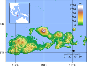 Location of the mouth  Brang Biji River (Indonesia) | |
| Location | |
| Country | Indonesia |
| Province | West Nusa Tenggara |
| Region | Sumbawa Regency |
| City | Sumbawa Besar |
| Physical characteristics | |
| Source | |
| • location | Batu Lanteh |
| Mouth | Flores Sea |
• location | Sumbawa Besar |
• coordinates | 8°27′58″S 117°24′14″E / 8.4661°S 117.4039°E |
• elevation | 0 m (0 ft) |
The Brang Biji River (Indonesian: Sungai Brang Biji; in Sumbawarese, "Brang" means "river") is a river in the island of Sumbawa, Indonesia, about 1,200 km east of the capital Jakarta.[1] It is also known as Brang Sumbawa.[2]
YouTube Encyclopedic
-
1/3Views:63 0471 269 1323 559
-
7 hour Nepali Road Trip to Langtang Valley Nepal🇳🇵| Langtang Trek
-
Painting Forest / Acrylic Painting Technique / Drawing A Pair Of Birds
-
Abandoned Hot Springs | Turkiye Border Crossing | VANLIFE IN GREECE
Transcription
Hydrology
The drainage basin of the Brang Biji covers an area of 225 km². The main river has a length of 33.20 km, with an upstream inclination of 17.14%, and the middle part inclination of 5.15%. It flows from south to north, passing Batu Lanteh at upriver and the city of Sumbawa Besar at downriver, into the Flores Sea.[3]
For years, the Brang Biji River suffers from rapid sedimentation, which reduces its water capacity, and decreasing width due to uncontrolled house building along the river banks.[4] These factors contribute to annual flood, submerging houses along the banks in the districts of Bugis, Brang Bara, Pekat, Samapuin, Lempeh and Brang Biji,[3] as happened in February 2017.[5]
The Brang Biji River is also heavily polluted by high concentrations of E-coli and mercury, reaching unsafe levels for people to use for drinking or washing.[6] The pollution is attributed to the unhygienic lifestyle of the community, such as throwing thrash and using the river as a restroom.[7]
Geography
The river flows along the northwestern area of Sumbawa with predominantly tropical savanna climate (designated as As in the Köppen-Geiger climate classification).[8] The annual average temperature in the area is 26 °C. The warmest month is October, when the average temperature is around 30 °C, and the coldest is February, at 24 °C.[9] The average annual rainfall is 1539 mm. The wettest month is January, with an average of 321 mm rainfall, and the driest is August, with 3 mm rainfall.[10]
See also
- List of drainage basins of Indonesia
- List of rivers of Indonesia
- List of rivers of Lesser Sunda Islands
References
- ^ Brang Biji at Geonames.org (cc-by); Database dump downloaded 2015-11-27
- ^ Brang Sumbawa at Geonames.org (cc-by); Database dump downloaded 2015-11-27
- ^ a b (in Indonesian) Fredy Benedictus Da Costa Rao, Saifoe El Unas, Pudyono. Studi Kelayakan Investasi Pembangunan Bendungan Krekeh Kabupaten Sumbawa Berdasarkan Aspek Ekonomi - Jurnal Mahasiswa Teknik Sipil Fakultas Teknik Universitas Brawijaya - Vol 1, No 3 (2015).
- ^ (in Indonesian) Benahi Infrastruktur, "Jinakkan" Banjir Archived 2017-08-30 at the Wayback Machine - SUARANTB.com - 20 Februari 2017.
- ^ (in Indonesian) 10 Bencana Alam Landa Indonesia dalam Sepekan - Republika - 12 Februari 2017.
- ^ (in Indonesian) Enam Sungai di NTB Tercemar Limbah Berat Archived 2017-08-30 at the Wayback Machine - Aktual.com - Desember 14, 2015.
- ^ (in Indonesian) Perilaku Hidup Bersih Masih Rendah, Sungai-sungai Besar di NTB Tercemar Tinja - Global FM - 16 Desember 2015.
- ^ Peel, M C; Finlayson, B L; McMahon, T A (2007). "Updated world map of the Köppen-Geiger climate classification" (PDF). Hydrology and Earth System Sciences. 11. doi:10.5194/hess-11-1633-2007.
- ^ "NASA Earth Observations Data Set Index". NASA. 30 January 2016. Archived from the original on 10 May 2020. Retrieved 29 August 2017.
- ^ "NASA Earth Observations: Rainfall (1 month - TRMM)". NASA/Tropical Rainfall Monitoring Mission. 30 January 2016. Archived from the original on 19 April 2019. Retrieved 29 August 2017.