
Mošorin
Мошорин (Serbian) | |
|---|---|
 Vila Vlaškalić | |
 Mošorin  Mošorin  Mošorin | |
| Coordinates: 45°18′N 20°10′E / 45.300°N 20.167°E | |
| Country | |
| Province | |
| District | South Bačka District |
| Municipality | Titel |
| Area | |
| • Total | 41.3 km2 (15.9 sq mi) |
| Elevation | 111 m (364 ft) |
| Population (2011) | |
| • Total | 2,569 |
| • Density | 62/km2 (160/sq mi) |
| Time zone | UTC+1 (CET) |
| • Summer (DST) | UTC+2 (CEST) |
Mošorin (Serbian Cyrillic: Мошорин; Hungarian: Mozsor) is a village located in the Titel municipality, South Bačka District, Vojvodina, Serbia. The village has a Serb ethnic majority and its population numbering 2,569 people (as of 2011 census).
YouTube Encyclopedic
-
1/4Views:1 6911 2382 8191 882
-
Grad opustosio atar Mosorina - U nasem ataru 903
-
Mošorin - priča o dušama
-
Uzgoj ovaca rase Virtemberg u Mosorinu - U nasem ataru 822
-
Vojvodjanska tradicija Mosorin I 30 05 2015 HD
Transcription
History
The village was first time mentioned in the 16th century. During the Ottoman rule (16th-17th century), it was populated by ethnic Serbs. Since 1699, it was under Habsburg rule and was part of the Habsburg Military Frontier (Šajkaš Battalion). In 1848-1849, Mošorin was part of the Serbian Vojvodina, a Serb autonomous region within Austrian Empire, but since 1849, it is again part of the Military Frontier, until 1873 when it was included into Bačka-Bodrog county.
Since 1918, Mošorin is part of the Kingdom of Serbs, Croats and Slovenes (later known as Yugoslavia). Between 1918 and 1922 it was part of Bačka county, between 1922 and 1929 part of Belgrade oblast, and between 1929 and 1941 part of the Danube Banovina.
In 1941, the village was occupied by Axis troops and attached to Horthy's Hungary. In the 1942 raid, performed on Orthodox Christmas, the Hungarian troops killed 205 villagers, including 94 men, 41 women, 44 children and 26 old persons, of whom 170 were Serbs, 34 Romani, and 1 Hungarian. Part of the corpses of the killed villagers was thrown into the iced waters of the river Tisa, while other part was buried into four mass graves.
Axis occupation ended in 1944. Since then Mošorin was part of the new Socialist Yugoslavia. Between 1992 and 2003 it was part of the Federal Republic of Yugoslavia, between 2003 and 2006 part of Serbia and Montenegro, and since 2006, it is part of an independent Serbia.
Demographics
| Year | Pop. | ±% p.a. |
|---|---|---|
| 1961 | 2,906 | — |
| 1971 | 2,694 | −0.75% |
| 1981 | 2,483 | −0.81% |
| 1991 | 2,552 | +0.27% |
| 2002 | 2,763 | +0.72% |
| 2011 | 2,569 | −0.81% |
As of 2011 census, the village of Mošorin has a population of 2,569 inhabitants.
Famous people from Mošorin

- Svetozar Miletić (1826–1901), the political leader of Serbs in Vojvodina.
- Isidora Sekulić (1877–1958), a famous Serb literate, academician.
- Dušan Kanazir (1921–2009), a Serbian molecular biologist
- Mladen Dražetin (1951–2015), doctor of social sciences, intellectual, economist, theatrical creator, poet, writer and philosopher. He was born and died in Novi Sad, but spent part of his childhood in Mošorin, from where his father Rada originated.
- Milan Radin (1991–), football player.
Family names of the villagers
Some prominent families in the village include: Bačkalić, Banjac, Bedov, Bugarin, Dimitrov, Dražeta, Dudarin, Đurđević, Etinski, Ivošev, Ivanović, Jelovac, Jovanović, Jurišin, Kanazir, Karanov, Kirćan, Kozarev, Kolarić, Krunić, Kuruca, Maletin, Marić, Marjanov, Miletić, Milnović, Mirosavljev, Nestorović, Pantelemonov, Petakov, Požarev, Rakić, Ranisavljev, Savin, Svirčev, Sekulić, Stanojev, Subotin, Suzić, Tubić, Vlaškalić, etc.
See also
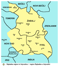
- Šajkaška
- South Bačka District
- Bačka
- List of places in Serbia
- List of cities, towns and villages in Vojvodina
References
- Slobodan Ćurčić, Broj stanovnika Vojvodine, Novi Sad, 1996.