
Moland Municipality
Moland kommune | |
|---|---|
 Flag | |
 Aust-Agder within Norway | |
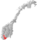
 Moland within Aust-Agder | |
| Coordinates: 58°32′52″N 08°48′40″E / 58.54778°N 8.81111°E | |
| Country | Norway |
| County | Aust-Agder |
| District | Østre Agder |
| Established | 1 January 1962 |
| • Preceded by | Tvedestrand, Stokken, Austre Moland, and Flosta municipalities |
| Disestablished | 1 January 1992 |
| • Succeeded by | Arendal Municipality |
| Administrative centre | Eydehavn |
| Area (upon dissolution)[1] | |
| • Total | 127 km2 (49 sq mi) |
| Population (1992) | |
| • Total | 8,148 |
| • Density | 64/km2 (170/sq mi) |
| Demonym | Molending[2] |
| Time zone | UTC+01:00 (CET) |
| • Summer (DST) | UTC+02:00 (CEST) |
| ISO 3166 code | NO-0918[3] |

Moland is a former municipality in the old Aust-Agder county in Norway. The 127-square-kilometre (49 sq mi) municipality existed from 1962 until 1992 when it was merged into the present-day municipality of Arendal which is located in what is now Agder county. The administrative centre of the municipality was the village of Eydehavn which had a population of 6,011 in 1967 and 8,148 in 1992. Other villages in the municipality included Kilsund, Narestø, Saltrød, Brekka, Strengereid, Vatnebu, and Sagene. The municipality consisted of the mainland area to the north and northeast of the town of Arendal plus the islands of Flostaøya and Tverrdalsøya.[1]
YouTube Encyclopedic
-
1/5Views:385634304301596
-
MOBOX - MOland Defense Guide - Episode 01 - Auto Challenge Tutorial
-
MOBOX - Clash of MOland - First View And Review Of New Mobox Game
-
MOBOX - Clash of MOland Guide - Episode 01 - Dailies & Main Quests #1
-
MOland Defense Update & Season Rewards - MOBOX - Can We Even ROI? - Episode 06
-
MOBOX - MOland Defense Guide - Episode 11 - Benefits Of Spending Mbox Ingame
Transcription
History

During the 1960s, there were many municipal mergers across Norway due to the work of the Schei Committee. The municipality of Moland was created on 1 January 1962 when a merger took place between the municipalities of Stokken (population: 2,783), Austre Moland (population: 1,607), and Flosta (population: 1,205) as well as Strengereid area (population: 375) of the municipality of Tvedestrand. On 1 January 1964, the Holte farm (population: 5) in Moland was transferred to Tvedestrand.[4]
On 1 January 1992, another major municipality merger took place in this area. The municipalities of Moland (population: 8,148), Øyestad (population: 8,679), Tromøy (population: 4,711), and Hisøy (population: 4,026) were merged with the town of Arendal (population: 12,478) to form the new, much larger, municipality of Arendal with a population of nearly 40,000 people.[4]
Name
The municipality (originally the parish) is named after the old Moland farm (Old Norse: Móðguland). The first element of the name is derived from the river Móðga. The river name comes from the Old Norse word móðigr which means "brave" or "courageous". The last element is land which means "land" or "district". The predecessor municipality of Austre Moland had the prefix austre (which means "eastern") which was added to differentiate the place from Vestre Moland which was located a little further south along the coast of Norway, but since that municipality was dissolved, the prefix here was no longer needed.[5]
Coat of arms
The coat of arms was granted on 7 January 1983. The official blazon is "Azure, a double chevron argent" (Norwegian: I blått en sølv dobbeltsparre). This means the arms have a blue field (background) and the charge is a double chevron that looks like the letter "M". The double chevron has a tincture of argent which means it is commonly colored white, but if it is made out of metal, then silver is used. The blue color in the field symbolizes the importance of the sea for this municipality which had a long and rugged coastline. The double chevron design was chosen since it looks like the letter "M", the initial letter in the name of the municipality. The three points in the "M" also refer to the three areas that formed Moland municipality: Stokken, Flosta, and Austre Moland. The arms were designed by Oddvar André Enggav.[6][7][8]
Government
While it existed, this municipality was responsible for primary education (through 10th grade), outpatient health services, senior citizen services, unemployment, social services, zoning, economic development, and municipal roads. During its existence, this municipality was governed by a municipal council of directly elected representatives. The mayor was indirectly elected by a vote of the municipal council.[9]
Municipal council
The municipal council (Herredsstyre) of Moland was made up of representatives that were elected to four-year terms. The tables below show the historical composition of the council by political party.
| Party name (in Norwegian) | Number of representatives | |
|---|---|---|
| Labour Party (Arbeiderpartiet) | 15 | |
| Progress Party (Fremskrittspartiet) | 3 | |
| Conservative Party (Høyre) | 6 | |
| Christian Democratic Party (Kristelig Folkeparti) | 3 | |
| Centre Party (Senterpartiet) | 1 | |
| Socialist Left Party (Sosialistisk Venstreparti) | 1 | |
| Liberal Party (Venstre) | 2 | |
| Total number of members: | 31 | |
| Party name (in Norwegian) | Number of representatives | |
|---|---|---|
| Labour Party (Arbeiderpartiet) | 16 | |
| Progress Party (Fremskrittspartiet) | 2 | |
| Conservative Party (Høyre) | 7 | |
| Christian Democratic Party (Kristelig Folkeparti) | 4 | |
| Centre Party (Senterpartiet) | 1 | |
| Liberal Party (Venstre) | 1 | |
| Total number of members: | 31 | |
| Party name (in Norwegian) | Number of representatives | |
|---|---|---|
| Labour Party (Arbeiderpartiet) | 14 | |
| Conservative Party (Høyre) | 9 | |
| Christian Democratic Party (Kristelig Folkeparti) | 5 | |
| Centre Party (Senterpartiet) | 1 | |
| Liberal Party (Venstre) | 2 | |
| Total number of members: | 31 | |
| Party name (in Norwegian) | Number of representatives | |
|---|---|---|
| Labour Party (Arbeiderpartiet) | 16 | |
| Conservative Party (Høyre) | 6 | |
| Christian Democratic Party (Kristelig Folkeparti) | 5 | |
| New People's Party (Nye Folkepartiet) | 2 | |
| Centre Party (Senterpartiet) | 2 | |
| Total number of members: | 31 | |
| Party name (in Norwegian) | Number of representatives | |
|---|---|---|
| Labour Party (Arbeiderpartiet) | 17 | |
| Conservative Party (Høyre) | 5 | |
| Christian Democratic Party (Kristelig Folkeparti) | 3 | |
| Centre Party (Senterpartiet) | 2 | |
| Liberal Party (Venstre) | 4 | |
| Total number of members: | 31 | |
| Party name (in Norwegian) | Number of representatives | |
|---|---|---|
| Labour Party (Arbeiderpartiet) | 17 | |
| Conservative Party (Høyre) | 5 | |
| Christian Democratic Party (Kristelig Folkeparti) | 3 | |
| Centre Party (Senterpartiet) | 1 | |
| Liberal Party (Venstre) | 5 | |
| Total number of members: | 31 | |
| Party name (in Norwegian) | Number of representatives | |
|---|---|---|
| Labour Party (Arbeiderpartiet) | 18 | |
| Conservative Party (Høyre) | 5 | |
| Christian Democratic Party (Kristelig Folkeparti) | 2 | |
| Centre Party (Senterpartiet) | 1 | |
| Liberal Party (Venstre) | 5 | |
| Total number of members: | 31 | |
Mayors
The mayors (Norwegian: ordfører) of Moland:
Notable people
- Tore A. Liltved, a local politician
- Thor Lund, a local politician and mechanic
See also
References
- ^ a b Thorsnæs, Geir, ed. (14 January 2016). "Moland". Store norske leksikon (in Norwegian). Kunnskapsforlaget. Retrieved 27 November 2017.
- ^ "Navn på steder og personer: Innbyggjarnamn" (in Norwegian). Språkrådet.
- ^ Bolstad, Erik; Thorsnæs, Geir, eds. (26 January 2023). "Kommunenummer". Store norske leksikon (in Norwegian). Kunnskapsforlaget.
- ^ a b Jukvam, Dag (1999). "Historisk oversikt over endringer i kommune- og fylkesinndelingen" (PDF) (in Norwegian). Statistisk sentralbyrå. ISBN 9788253746845.
- ^ Rygh, Oluf (1905). Norske gaardnavne: Nedenes amt (in Norwegian) (8 ed.). Kristiania, Norge: W. C. Fabritius & sønners bogtrikkeri. p. 87.
- ^ "Civic heraldry of Norway - Norske Kommunevåpen". Heraldry of the World. Retrieved 20 January 2023.
- ^ "Moland, Arendal, Aust-Agder (Norway)". Flags of the World. Retrieved 20 January 2023.
- ^ "Godkjenning av våpen og flagg". Lovdata.no (in Norwegian). Norges kommunal- og arbeidsdepartementet. 7 January 1983. Retrieved 20 January 2023.
- ^ Hansen, Tore; Vabo, Signy Irene, eds. (20 September 2022). "kommunestyre". Store norske leksikon (in Norwegian). Kunnskapsforlaget. Retrieved 1 January 2023.
- ^ "Kommunestyrevalget 1987" (PDF) (in Norwegian). Oslo-Kongsvinger: Statistisk sentralbyrå. 1988. Retrieved 21 December 2020.
- ^ "Kommunestyrevalget 1983" (PDF) (in Norwegian). Oslo-Kongsvinger: Statistisk sentralbyrå. 1984. Retrieved 21 December 2020.
- ^ "Kommunestyrevalget 1979" (PDF) (in Norwegian). Oslo: Statistisk sentralbyrå. 1979. Retrieved 21 December 2020.
- ^ "Kommunevalgene 1975" (PDF) (in Norwegian). Oslo: Statistisk sentralbyrå. 1977. Retrieved 21 December 2020.
- ^ "Kommunevalgene 1972" (PDF) (in Norwegian). Oslo: Statistisk sentralbyrå. 1973. Retrieved 21 December 2020.
- ^ "Kommunevalgene 1967" (PDF) (in Norwegian). Oslo: Statistisk sentralbyrå. 1967. Retrieved 21 December 2020.
- ^ "Kommunevalgene 1963" (PDF) (in Norwegian). Oslo: Statistisk sentralbyrå. 1964. Retrieved 21 December 2020.
- ^ a b "Lund, Thor (1921-1999)" (in Norwegian). Stortinget. Retrieved 23 July 2023.
- ^ "Liltved, Tore A. (1939-2004)" (in Norwegian). Stortinget. Retrieved 23 July 2023.
External links
 Arendal travel guide from Wikivoyage
| |||||||||||
 | Towns and cities |
| |||||||||
| Municipalities |
| ||||||||||
| |||||||||||