
Municipality of Mocorito | |
|---|---|
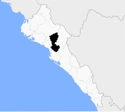 Location of the municipality in Sinaloa | |
| Coordinates: 25°29′00″N 107°55′00″W / 25.48333°N 107.91667°W | |
| Country | |
| State | Sinaloa |
| Seat | Mocorito |
| Government | |
| • Municipal President | María Elizalde Ruelas |
| Area | |
| • Total | 2,800 km2 (1,100 sq mi) |
| Elevation | 187 m (614 ft) |
| Population (2020) | |
| • Total | 30,358 |
| • Density | 14.4/km2 (37/sq mi) |
| Time zone | UTC-7 (Mountain Standard Time) |
| • Summer (DST) | UTC-6 (Mountain Daylight Time) |
| Website | www |
Municipality of Mocorito is a municipality in the Mexican state of Sinaloa in northwestern Mexico.[1] It is bordered to the north by the municipality of Sinaloa, to the south by Navolato, to the southeast by Culiacán, to the east by Badiraguato and to the west with Salvador Alvarado and Angostura. It encompasses a total of 2,800.6 km² and represents 4.9% of the territory of Sinaloa. According to the 2020 census it had a population of 40,358, compromising 270 total localities. Major localities include Pericos, Mocorito, and Caimanero.
Flora and Fauna
The three climatic regions that make up Sinaloa can be seen in Mocorito. Tropical savanna in the west, mountainous in the east, and a transitional zone in the central region. Each has its own vegetation. The mountainous regions are composed of conifers, oaks, and pine trees. In the foothills amapas, ebony, cedar, and juniper trees are commonly found. The coastal region of Mocorito is abundant with various grasses and bushes, mangroves, Manila tamarinds, mesquites, and wild fig trees.
Most arable land in Mocorito is used to farm temporary crops. This includes rice, soybeans, safflower, wheat, cottonseed, sesame, beans, cotton, sugarcane, and corn. Fruit trees are also grown; this includes melon, watermelon, avocado, mango, orange, and papaya.
Cattle raised include pigs, goats, and sheep. The wildlife include deer, hare, rabbits, armadillos, iguanas, and more. Predators also proliferate in the area, with animals such as wildcats, ocelots, and mountain lions living deep in the mountainous regions.
Climate
| Climate data for Culiacán International Airport | |||||||||||||
|---|---|---|---|---|---|---|---|---|---|---|---|---|---|
| Month | Jan | Feb | Mar | Apr | May | Jun | Jul | Aug | Sep | Oct | Nov | Dec | Year |
| Record high °F | 102.69 | 104.59 | 106.5 | 106.5 | 110.32 | 112.23 | 110.32 | 108.42 | 106.5 | 108.41 | 106.5 | 102.69 | 112.23 |
| Mean daily maximum °F | 87.06 | 88.75 | 93.69 | 96.42 | 100.11 | 100.26 | 98.74 | 98.29 | 97.05 | 98.1 | 93.29 | 87.03 | 94.89 |
| Daily mean °F | 74.97 | 77.11 | 81.97 | 85.69 | 90.32 | 92.08 | 91.54 | 90.63 | 89.13 | 88.09 | 82.0 | 75.29 | 84.9 |
| Mean daily minimum °F | 60.31 | 63.25 | 66.76 | 72.61 | 79.54 | 81.03 | 78.71 | 76.84 | 76.84 | 72.68 | 66.63 | 60.93 | 69.89 |
| Record low °F | 47.28 | 35.82 | 49.19 | 56.84 | 60.66 | 70.21 | 74.03 | 74.03 | 70.21 | 60.66 | 51.5 | 47.28 | 35.82 |
| Average precipitation inches | 0.53 | 1.31 | 0.27 | 0.13 | 0.27 | 2.59 | 7.5 | 8.55 | 8.87 | 2.14 | 1.85 | 0.96 | 2.91 |
| Record high °C | 39.27 | 40.33 | 41.4 | 41.4 | 43.51 | 44.57 | 43.51 | 42.46 | 41.4 | 42.45 | 41.4 | 39.27 | 44.57 |
| Mean daily maximum °C | 30.59 | 31.53 | 34.27 | 35.79 | 37.84 | 37.92 | 37.08 | 36.83 | 36.14 | 36.7 | 34.05 | 30.57 | 34.94 |
| Daily mean °C | 23.87 | 25.06 | 27.76 | 29.83 | 32.40 | 33.38 | 33.08 | 32.57 | 31.74 | 31.16 | 27.8 | 24.05 | 29.4 |
| Mean daily minimum °C | 15.73 | 17.36 | 19.31 | 22.56 | 26.41 | 27.24 | 25.95 | 24.91 | 24.91 | 22.60 | 19.24 | 16.07 | 21.05 |
| Record low °C | 8.49 | 2.12 | 9.55 | 13.80 | 15.92 | 21.23 | 23.35 | 23.35 | 21.23 | 15.92 | 10.8 | 8.49 | 2.12 |
| Average precipitation mm | 13 | 33 | 6.9 | 3.3 | 6.9 | 66 | 190 | 217 | 225 | 54 | 47 | 24 | 74 |
| Average precipitation days | 2.41 | 3.09 | 1.25 | 0.29 | 1.44 | 13.12 | 27.5 | 28.27 | 22.57 | 6.56 | 4.25 | 2.6 | 9.45 |
| Average relative humidity (%) | 51.43 | 51.29 | 43.56 | 44.07 | 44.1 | 60.87 | 71.35 | 79.08 | 79.36 | 67.52 | 56.58 | 54.74 | 58.66 |
| Mean daily sunshine hours | 8.98 | 11.14 | 12.02 | 13.53 | 14.0 | 14.35 | 13.97 | 13.5 | 12.75 | 9.15 | 9.1 | 8.97 | 11.79 |
| Source 1: [citation needed] | |||||||||||||
| Source 2: [citation needed] | |||||||||||||
Demographics
Localities
The 10 largest localities according to the 2010 INEGI census are as follows:
| Locality | Population |
| Total | 40,358 |
| Pericos | 6,244 |
| Mocorito | 5,926 |
| Caimanero | 1,881 |
| Melchor Ocampo | 1,933 |
| Recoveco | 1,618 |
| Higuera de los Vega | 1,256 |
| Potrero de los Sánchez (Estación Techa) | 1,205 |
| Cerro Agudo | 1,003 |
| El Valle de Leyva Solano (El Valle) | 955 |
| Rancho Viejo | 838 |
References
- ^ "Sinaloa". Enciclopedia de los Municipios de México. Instituto Nacional para el Federalismo y el Desarrollo Municipal. Archived from the original on 28 January 2007. Retrieved January 11, 2010.

| Authority control databases: Geographic |
|---|
25°29′N 107°55′W / 25.483°N 107.917°W