
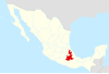
La Mixteca is a cultural, economic and political region in Western Oaxaca and neighboring portions of Puebla, Guerrero in south-central Mexico, which refers to the home of the Mixtec people. In their languages, the region is called either Ñuu Djau, Ñuu Davi or Ñuu Savi. Two-thirds of all Mixtecs live in the region, and the entire national population of Mixtecs in Mexico was 500,000 in 1999.[1]
The region covers some 40,000 km2 (15,000 sq mi) where two of the country's mountain ranges, the Neo-Volcanic Belt and Sierra Madre del Sur, converge.
YouTube Encyclopedic
-
1/3Views:6447 8221 750
-
Oaxaca - Ruta de la Mixteca
-
México Bello Caminos De Oaxaca En La Mixteca
-
La Mixteca late fuerte / Mixteca Oaxaqueña
Transcription
Geography
La Mixteca is a country of great contrasts. The Sierra Madre del Sur and the Neo-Volcanic Belt mark its northern limits. To the east, it is defined by the Cuicatlán Valley and the Central Valleys of Oaxaca. To the west, the Mixteca region is adjacent to the valleys of Morelos and the central portion of Guerrero. To the south lies 200 miles of Pacific Ocean coastline. Because of the presence of the major mountains of the Sierra Mixteca, communications with the rest of the country are difficult. The region tends to be remote, poor, and little-visited.[2]
The region is conventionally divided into three separate areas, defined by the prevailing height of the terrain:

- Mixteca Baja ("Low Mixteca"): northwest Oaxaca and southwest Puebla.
- Mixteca Alta ("High Mixteca"): northeast Guerrero and western Oaxaca.
- Mixteca de la Costa ("Coastal Mixteca"): the area also known as the Costa Chica, the remote Pacific coastline of eastern Guerrero and western Oaxaca, home to Mixteca, Amuzgo, and Afro-Mexicans[3]
See also
References
- ^ "Mixtec.org - About". Latin American Studies Department. San Diego State University. Retrieved 30 May 2017.
- ^ Vaughn, Bobby. "Mexico's Black heritage: the Costa Chica of Guerrero and Oaxaca". Mexconnect. Retrieved 30 May 2017.
- ^ Okeowo, Alexis (28 June 2009). "African Roots Still Run Deep For Blacks on Mexican Coast". Washington Post. Retrieved 30 May 2017.
| Authority control databases: National |
|---|