TD12 Minami-sakurai Station 南桜井駅 | ||||||||||||||||||||||||||||
|---|---|---|---|---|---|---|---|---|---|---|---|---|---|---|---|---|---|---|---|---|---|---|---|---|---|---|---|---|
 Minami-sakurai Station north entrance in August 2012 | ||||||||||||||||||||||||||||
| General information | ||||||||||||||||||||||||||||
| Location | 118 Yonejima, Kasukabe-shi, Saitama-ken 344-0115 Japan | |||||||||||||||||||||||||||
| Operated by | ||||||||||||||||||||||||||||
| Line(s) | ||||||||||||||||||||||||||||
| Distance | 20.6 km from Ōmiya | |||||||||||||||||||||||||||
| Platforms | 2 side platforms | |||||||||||||||||||||||||||
| Other information | ||||||||||||||||||||||||||||
| Station code | TD-12 | |||||||||||||||||||||||||||
| Website | Official website | |||||||||||||||||||||||||||
| History | ||||||||||||||||||||||||||||
| Opened | 9 December 1930 | |||||||||||||||||||||||||||
| Previous names | Naganuma Temporary Stop (to 1932) | |||||||||||||||||||||||||||
| Passengers | ||||||||||||||||||||||||||||
| FY2019 | 14,515 daily | |||||||||||||||||||||||||||
| Services | ||||||||||||||||||||||||||||
| ||||||||||||||||||||||||||||
| Location | ||||||||||||||||||||||||||||
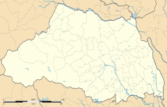
Minami-sakurai Station (南桜井駅, Minami-sakurai-eki) is a passenger railway station located in the city of Kasukabe, Saitama, Japan, operated by the private railway operator Tōbu Railway. The station is numbered "TD-12".
Lines
Minami-sakurai Station is served by the 62.7 km (39.0 mi) Tobu Urban Park Line (formerly known as the "Tobu Noda Line") from Ōmiya in Saitama Prefecture to Funabashi in Chiba Prefecture, and lies 20.6 km (12.8 mi) from the western terminus of the line at Ōmiya.
Station layout
The station consists of two ground-level opposing side platforms serving two tracks, with an elevated station building located above.
Platforms
| 1 | ■ Urban Park Line | for Kasukabe, Iwatsuki, and Ōmiya |
| 2 | ■ Urban Park Line | for Nodashi, Kashiwa, and Funabashi |
History
Minami-sakurai Station opened on 9 December 1930[1] as the Naganuma Temporary Stop (永沼臨時停留所, Naganuma Rinji Teiryujo). On 1 August 1932 it was relocated 400 meters towards Kashiwa and elevated in status to a full station with its present name. On 6 November 1943, a new station named Yonejima Station (米島駅, Yonejima eki) was established 800 meters in the direction of Kashiwa for freight operations. This station ceased operations on 30 September 1945, and was abolished on 23 December 1956, and Minami-sakurai Station was relocated to its location. From 17 March 2012, station numbering was introduced on the Tobu Noda Line, with Minami-sakurai Station becoming "TD-12".[2]
Passenger statistics
In fiscal 2019, the station was used by an average of 14,515 passengers daily.[3]
Surrounding area
- Metropolitan Area Outer Underground Discharge Channel ("G-Cans")
- Former Shōwa, Saitama Town Hall
- Shōwa Post Office
See also
References
- ^ Terada, Hirokazu (19 January 2013). データブック日本の私鉄 [Databook: Japan's Private Railways]. Japan: Neko Publishing. p. 224. ISBN 978-4-7770-1336-4.
- ^ 「東武スカイツリーライン」誕生! あわせて駅ナンバリングを導入し、よりわかりやすくご案内します [Tobu Sky Tree Line created! Station numbering to be introduced at same time] (PDF). Tobu News (in Japanese). Tobu Railway. 9 February 2012. Archived from the original (pdf) on 8 August 2012. Retrieved 7 May 2013.
- ^ 駅情報(乗降人員) [Station information: Passenger figures] (in Japanese). Japan: Tobu Railway. 2021. Retrieved 5 January 2021.
External links
![]() Media related to Minami-Sakurai Station (Saitama) at Wikimedia Commons
Media related to Minami-Sakurai Station (Saitama) at Wikimedia Commons
- Station information (Tobu) (in Japanese)
35°58′50″N 139°48′29″E / 35.98056°N 139.80806°E


