
Mendon Township | |
|---|---|
 Amusement rides at the Adams County Fairgrounds | |
 Location in Adams County | |
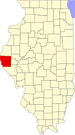 Adams County's location in Illinois | |
| Coordinates: 40°05′19″N 91°17′41″W / 40.08861°N 91.29472°W | |
| Country | United States |
| State | Illinois |
| County | Adams |
| Established | November 6, 1849 |
| Area | |
| • Total | 36.76 sq mi (95.2 km2) |
| • Land | 36.65 sq mi (94.9 km2) |
| • Water | 0.11 sq mi (0.3 km2) 0.30% |
| Elevation | 728 ft (222 m) |
| Population (2020) | |
| • Total | 1,445 |
| • Density | 39/sq mi (15/km2) |
| Time zone | UTC-6 (CST) |
| • Summer (DST) | UTC-5 (CDT) |
| ZIP codes | 62301, 62338, 62349, 62351, 62376 |
| FIPS code | 17-001-48320 |
Mendon Township is one of twenty-two townships in Adams County, Illinois, United States. As of the 2020 census, its population was 1,445 and it contained 600 housing units.[1]
The township is named after Mendon, Massachusetts.[2]
YouTube Encyclopedic
-
1/3Views:6 3548 8253 011
-
What Will I Learn: Veterinary Technology
-
Can't Stop The Feeling Lip Sync by LMU-College of Veterinary Medicine
-
Recovery Options: Treatment for Drug Addiction and Alcoholism
Transcription
Geography
According to the 2010 census, the township has a total area of 36.76 square miles (95.2 km2), of which 36.65 square miles (94.9 km2) (or 99.70%) is land and 0.11 square miles (0.28 km2) (or 0.30%) is water.[3]
Cities
Cemeteries
The township contains three cemeteries: Franklin, Moyer and Saint Joseph.
Major highways
Airports and landing strips
- Cramm Landing Area
Demographics
As of the 2020 census[1] there were 1,445 people, 603 households, and 453 families residing in the township. The population density was 39.26 inhabitants per square mile (15.16/km2). There were 600 housing units at an average density of 16.30 per square mile (6.29/km2). The racial makeup of the township was 95.22% White, 0.48% African American, 0.00% Native American, 0.00% Asian, 0.00% Pacific Islander, 0.62% from other races, and 3.67% from two or more races. Hispanic or Latino of any race were 1.11% of the population.
There were 603 households, out of which 43.10% had children under the age of 18 living with them, 62.85% were married couples living together, 8.46% had a female householder with no spouse present, and 24.88% were non-families. 24.20% of all households were made up of individuals, and 17.10% had someone living alone who was 65 years of age or older. The average household size was 2.74 and the average family size was 3.25.
The township's age distribution consisted of 30.4% under the age of 18, 6.1% from 18 to 24, 22.8% from 25 to 44, 23.2% from 45 to 64, and 17.4% who were 65 years of age or older. The median age was 38.5 years. For every 100 females, there were 99.6 males. For every 100 females age 18 and over, there were 86.9 males.
The median income for a household in the township was $68,854, and the median income for a family was $86,125. Males had a median income of $41,979 versus $37,750 for females. The per capita income for the township was $29,633. About 4.9% of families and 6.4% of the population were below the poverty line, including 8.7% of those under age 18 and 7.8% of those age 65 or over.
| Census | Pop. | Note | %± |
|---|---|---|---|
| 2010 | 1,520 | — | |
| 2020 | 1,445 | −4.9% | |
| U.S. Decennial Census[4] | |||
School districts
- Community Unit School District 4
Political districts
- Illinois' 17th congressional district
- State House District 93
- State Senate District 47
References
- "Mendon Township, Adams County, Illinois". Geographic Names Information System. United States Geological Survey, United States Department of the Interior. Retrieved January 4, 2010.
- United States Census Bureau 2007 TIGER/Line Shapefiles
- United States National Atlas
- ^ a b "Explore Census Data". data.census.gov. Retrieved January 22, 2023.
- ^ Gannett, Henry (1905). The Origin of Certain Place Names in the United States. U.S. Government Printing Office. p. 205.
- ^ "Population, Housing Units, Area, and Density: 2010 - County -- County Subdivision and Place -- 2010 Census Summary File 1". United States Census. Archived from the original on February 12, 2020. Retrieved May 28, 2013.
- ^ "Census of Population and Housing". Census.gov. Retrieved June 4, 2016.
External links
Places adjacent to Mendon Township, Adams County, Illinois | |
|---|---|
Municipalities and communities of Adams County, Illinois, United States | ||
|---|---|---|
| City |  | |
| Town | ||
| Villages | ||
| Townships | ||
| CDPs | ||
| Other communities | ||