
Maltsevo
Мальцево | |
|---|---|
Location of Maltsevo  | |
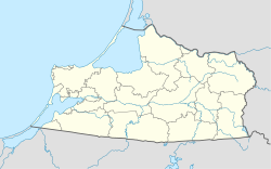 Maltsevo Location of Maltsevo 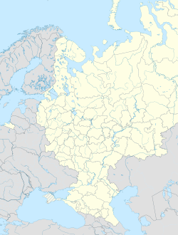 Maltsevo Maltsevo (European Russia)  Maltsevo Maltsevo (Russia) | |
| Coordinates: 54°22′20″N 21°43′0″E / 54.37222°N 21.71667°E | |
| Country | Russia |
| Federal subject | Kaliningrad Oblast |
| Time zone | UTC+2 (MSK–1 |
| Postal code(s)[2] | 238132 |
| OKTMO ID | 27716000331 |
Maltsevo (Russian: Мальцево; Polish: Karpówko[3] or Karpowo Małe;[4] Lithuanian: Mažoji Karpava) is a rural locality in Ozyorsky District of Kaliningrad Oblast, Russia, near the border with Poland. It has a population of 467 (2010 Russian census);[5] 471 (2002 Census);[6]
History
The village was founded by Polish people as Karpowo.[7]
Initially following World War II, in 1945, the village passed to Poland as Karpówko,[3] however, it was eventually annexed by the Soviet Union and renamed to Maltsevo.
References
- ^ "Об исчислении времени". Официальный интернет-портал правовой информации (in Russian). 3 June 2011. Retrieved 19 January 2019.
- ^ Почта России. Информационно-вычислительный центр ОАСУ РПО. (Russian Post). Поиск объектов почтовой связи (Postal Objects Search) (in Russian)
- ^ a b Rozporządzenie Ministrów Administracji Publicznej i Ziem Odzyskanych z dnia 1 października 1948 r. o przywróceniu i ustaleniu urzędowych nazw miejscowości., M.P. z 1948 r. Nr 78, poz. 692
- ^ Słownik geograficzny Królestwa Polskiego i innych krajów słowiańskich, Tom III (in Polish). Warszawa. 1882. p. 880.
{{cite book}}: CS1 maint: location missing publisher (link) - ^ Russian Federal State Statistics Service (2011). Всероссийская перепись населения 2010 года. Том 1 [2010 All-Russian Population Census, vol. 1]. Всероссийская перепись населения 2010 года [2010 All-Russia Population Census] (in Russian). Federal State Statistics Service.
- ^ Federal State Statistics Service (21 May 2004). Численность населения России, субъектов Российской Федерации в составе федеральных округов, районов, городских поселений, сельских населённых пунктов – районных центров и сельских населённых пунктов с населением 3 тысячи и более человек [Population of Russia, Its Federal Districts, Federal Subjects, Districts, Urban Localities, Rural Localities—Administrative Centers, and Rural Localities with Population of Over 3,000] (XLS). Всероссийская перепись населения 2002 года [All-Russia Population Census of 2002] (in Russian).
- ^ Maroszek, Józef (2007). Przewodnik historyczno-turystyczny po dziedzictwie kulturowym pogranicza Polska – Litwa – Kaliningrad (in Polish). Białystok. p. 388.
{{cite book}}: CS1 maint: location missing publisher (link)