
Malir District
ضلع ملیر ملير ضلعو | |
|---|---|
  | |
 Seal | |
 Map of Malir District | |
| Country | |
| Province | |
| Division | Karachi |
| Established | 1996 |
| Re-established | 11 July 2011 |
| Headquarters | DC Office Malir[1] |
| Towns | |
| Government | |
| • Type | District Administration |
| • Deputy Commissioner | Saeed Leghari[3] |
| Area | |
| • Total | 2,160 km2 (830 sq mi) |
| Population | |
| • Total | 2,403,959 |
| • Density | 1,100/km2 (2,900/sq mi) |
| Website | dcmalir |
Malir District (Urdu: ضلع ملير) is an administrative district of Karachi Division in Sindh, Pakistan.
History

Before the independence of Pakistan, there were small villages of Sindhi and Kalmati Baloch in the Gadap Town and Malir Town of modern Karachi. Now both towns are developed as the suburbs of the city because of the urban sprawl.[6]
Countryside
Malir has been regarded in history as the countryside of Karachi City due to its open atmosphere and lush green farms, but now these are no more.[7]
Agriculture land
Malir was once famous for its fruit and vegetable farms; but, now due to severe scarcity of groundwater, these farmlands are being converted into residential areas, thus increasing urbanization and environmental degradation. The Society for Conservation and Protection of Environment (SCOPE) has been concerned about drought and desertification in Malir district and has launched a campaign against illegal sand and gravel mining in dry river beds of Malir and its tributaries. Because sand and gravel mining cause lowering of ground water, as rainwater can cannot percolate in the aquifer. SCOPE is developing rainwater reservoirs in drought affected rural areas.[8]
Administrative status
Malir District was established in 1996.
Malir District was abolished in 2000 and divided into three towns namely:
- Malir Town,
- Bin-Qasim Town
- and Gadap Town.
On 11 July 2011, Sindh Government restored again Malir District.[9]
In 2022, a/c to Local Election Act -2022 (amended), Malir District was divided into three "Town Municipal Corporation" [10] namely:
Headed by its elected Chairman and a vice-chairman.
and also 6 subdivisions namely:
- Airport
- Bin-Qasim
- Gadap Town
- Ibrahim Hyderi Town
- Shah Mureed
- Murad Memon Goth
Each subdivision's headed by an Assistant Commissioner.
Demographics
At the time of the 2017 census, Malir district had 317,318 households and a population of 1,924,346. Malir had a sex ratio of 870 females per 1000 males and a literacy rate of 63.69%: 69.85% for males and 56.43% for females. 1,066,712 (55.43%) lived in urban areas. 504,348 (26.21%) were under 10 years of age.[11] In 2023, the district had 416,512 households and a population of 2,403,959.[5]
The majority religion is Islam, with 96.39% of the population. Christianity is practiced by 1.78% and Hinduism (including Scheduled Castes) is practiced by 1.77% of the population.
Languages
At the time of the 2017 census, 31.37% of the population spoke Sindhi, 19.37% Pashto, 12.91% Urdu, 12.08% Punjabi, 8.18% Balochi, 6.83% Hindko, 3.96% Saraiki and 1.26% Brahui as their first language.[11]
See also
- Malir Development Authority
- Malir (disambiguation)
- Malir Expressway Project
- Malir River
- Malir Cantonment
- Malir Cantonment railway station
References
- ^ "Contact Us". dcmalir.sindh.gov.pk. Retrieved 31 December 2023.
- ^ "Division of UCs in Karachi - Notification" (PDF). lgdsindh.gov.pk. Local Government & Housing Town Planning Department - Government of Sindh. 27 April 2023. Retrieved 29 December 2023.
- ^ "Chaukhandi graveyard to undergo monumental uplift". Dawn (newspaper). 14 December 2023. Retrieved 14 December 2023.
- ^ "Core Team". dcmalir.sindh.gov.pk. Retrieved 31 December 2023.
- ^ a b "TABLE 1 : HOUSEHOLDS, POPULATION, HOUSEHOLD SIZE AND ANNUAL GROWTH RATE" (PDF). www.pbscensus.gov.pk. Pakistan Bureau of Statistics. 2023.
- ^ "From Zardaris to Makranis: How the Baloch came to Sindh". The Express Tribune. 27 March 2014. Retrieved 18 October 2020.
- ^ "Save the Green Belt of Malir". The Nation. 18 August 2019. Retrieved 18 October 2020.
- ^ "SCOPE - Society for Conservation and Protection of Environment". www.scope.org.pk. Retrieved 7 March 2022.
- ^ Five districts of Karachi restored, notification issued Geo TV News website, Published 11 July 2011, Retrieved 7 March 2022
- ^ "Karachi to have 26 towns, 233 union bodies under Sindh LG Act". Business Recorder (newspaper). 9 January 2022. Retrieved 22 January 2023.
- ^ a b c "District Wise Results / Tables (Census - 2017)". www.pbscensus.gov.pk. Pakistan Bureau of Statistics.
25°05′46″N 67°11′14″E / 25.0960°N 67.1871°E
Provincial capital: Karachi | ||
| Banbhore | 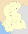 | |
| Hyderabad | ||
| Karachi | ||
| Larkana | ||
| Mirpur Khas | ||
| Shaheed Benazir Abad | ||
| Sukkur | ||