
Khairpur District
| |
|---|---|
  | |
 | |
| Coordinates: 27°32′N 68°46′E / 27.533°N 68.767°E | |
| Country | |
| Province | |
| Division | Sukkur |
| Established | 15 October 1955 |
| Government | |
| • Type | District Administration |
| • Deputy Commissioner | Sharjeel Noor Channa (PAS) |
| • District Police Officer | Mir Rohail Khoso (PSP) |
| • District Health Officer | N/A |
| Area | |
| • Total | 15,910 km2 (6,140 sq mi) |
| Population | |
| • Total | 2,597,535 |
| • Rank | 5th:Sindh |
| • Density | 160/km2 (420/sq mi) |
| Demonym | Khairpuri |
| Time zone | UTC+5 (PKT) |
| • Summer (DST) | UTC+5 |
| Calling code | 0243 |
| Number of Tehsils | 8 |
| Number of Union Councils | 89 |
Khairpur District (Sindhi: خيرپور ضلعو, Urdu: ضلع خیرپور) is a district in the Pakistani province of Sindh in Sukkur Division.[2]
At the 2017 census, it was the fifth most populated district in the province after four districts of Karachi city, with 2.4 million inhabitants. The headquarters of the district is the city of Khairpur. The district is further divided into eight sub-districts: Khairpur Tehsil, Mirwah Tehsil, Kot Diji Tehsil, Kingri Tehsil, Sobho Dero Tehsil, Gambat Tehsil, Faiz Ganj Tehsil and Nara Tehsil.[3]
YouTube Encyclopedic
-
1/5Views:4 0318 35841 3071 347390
-
KHAIRPUR MIRS CITY | Khairpur Mir's Sindh Pakistan | Khairpur City Tour | Pakistan Travel Vlog 2020
-
Khairpur Revisited - Episode 1 Part 1
-
The Beautiful Sindh EP11 | Khairpur | Kot Diji Fort | Sukkur City | Historical Pakistani Sites Tour
-
Desert Living In Sindh (Choondko, Khairpur)
-
Khairpur Date Farms - Khairpur District
Transcription
Location
Khairpur district is located between middle and northern Sindh. It is bounded on the north by Shikarpur District and Sukkur District, on the east by India, on the south by Sanghar District and Nawabshah District, and on the west by Larkana District, Naushahro Feroze District and Indus River. The revised area of the district is 15,910 km2.[3]
Demographics
| Year | Pop. | ±% p.a. |
|---|---|---|
| 1951 | 347,068 | — |
| 1961 | 500,258 | +3.72% |
| 1972 | 724,935 | +3.43% |
| 1981 | 981,190 | +3.42% |
| 1998 | 1,546,587 | +2.71% |
| 2017 | 2,405,190 | +2.35% |
| 2023 | 2,597,535 | +1.29% |
| Sources:[4] | ||
At the time of the 2017 census, Khairpur district had 405,726 households and a population of 2,405,523.[5] Khairpur had a sex ratio of 939 females per 1000 males and a literacy rate of 49.15%: 62.08% for males and 35.49% for females. 777,006 (32.31%) lived in urban areas. 796,830 (33.13%) were under 10 years of age.[5] In 2023, the district had 452,588 households and a population of 2,597,535.[1]
| Religion | Population (1941)[6]: 54–57 | Percentage (1941) | Population (2017)[5] | Percentage (2017) |
|---|---|---|---|---|
| Islam |
253,690 | 82.96% | 2,336,821 | 97.16% |
| Hinduism |
49,604 | 16.22% | 66,489 | 2.76% |
| Sikhism |
1,616 | 0.53% | — | — |
| Others [b] | 877 | 0.29% | 1,880 | 0.08% |
| Total Population | 305,787 | 100% | 2,405,190 | 100% |
The majority religion is Islam, with 97.16% of the population. Hinduism (including those from Scheduled Castes) is practiced by 2.76% of the population.
At the time of the 2017 census, 95.64% of the population spoke Sindhi and 1.55% Punjabi as their first language.[5]
Politics
The National Assembly.
The District of Khairpur is mapped into three constituencies at the national level. The constituencies include NA-208 Khairpur-I, NA-209 Khairpur-II, and NA-210 Khairpur-III.
Following is the list of the Member National Assemblies(MNAs) representing district in the National Assembly of Pakistan.
| Member of National Assembly | Constituency | Party | Election Year |
|---|---|---|---|
| Syed Nafisa Shah | NA-208 Khairpur-I | PPP | 2018 |
| Syed Javed Shah | NA-209 Khairpur-II | PPP | 2018 |
| Syed Fazal Shah | NA-210 Khairpur-III | PPP | 2018 |
The Provincial Assembly
The District of Khairpur is represented by the seven constituencies in the Provincial Assembly of Sindh.
| Member of Provincial Assembly | Constituency | Party | Year |
|---|---|---|---|
| Syed Qaim Ali Shah | PS-26 Khairpur-I | PPP | 2018 |
| Munawar Wassan | PS-27 Khairpur-II | PPP | 2018 |
| Sajid Banbhan | PS-28 Khairpur-III | PPP | 2018 |
| Muhammad Rafique Banbhan | PS-29 Khairpur-IV | GDA | 2018 |
| Syed Fazal Ali Shah | PS-30 Khairpur-V | PPP | 2018 |
| Naeem Ahmed Kharal | PS-31 Khairpur-VI | PPP | 2018 |
| Syed Rashid Shah Rashidi | PS-32 Khairpur-VII | GDA | 2018 |
Administration
It has 8 tehsils, 76 Union councils, 11 towns, 6800 Villages and total population 1,546,587 (Male 810,448 and Female Population 736,139) according to (Census) 1998.[3]
The eight tehsils[3] of the district are:
- Faiz Ganj Tehsil[5]
- Gambat Tehsil
- Khairpur Tehsil[5]
- Kingri Tehsil
- Kot Diji Tehsil[5]
- Nara Tehsil
- Sobho Dero Tehsil[5]
- Mirwah Tehsil
People from Khairpur District
- Pir Pagaro - President of Pakistan Muslim League (F)
- Sachal Sarmast - eighteenth-Century Sufi Poet
- Qaim Ali Shah - former Chief Minister of Sindh Province
- Ghous Ali Shah - former Defense Minister of Pakistan and Former Chief Minister of Sindh province
- Mir Ali Murad Talpur - former ruler of the princely state of Khairpur
Notes
- ^ Khairpur State
- ^ Including Jainism, Christianity, Buddhism, Zoroastrianism, Judaism, Ad-Dharmis, or not stated
References
- ^ a b "TABLE 1 : HOUSEHOLDS, POPULATION, HOUSEHOLD SIZE AND ANNUAL GROWTH RATE" (PDF). Pakistan Bureau of Statistics, Government of Pakistan website. 2023. Retrieved 21 January 2024.
- ^ "Khairpur: then and now - Daily Times". Daily Times. 6 February 2018. Retrieved 16 May 2018.
- ^ a b c d "Khairpur District Information". Population Welfare Department, Government of Sindh website. Archived from the original on 28 March 2015. Retrieved 21 January 2024.
- ^ "Population by administrative units 1951-1998" (PDF). Pakistan Bureau of Statistics.
- ^ a b c d e f g h "District And Tehsil Level Population Summary - Khairpur District (2017 census)" (PDF). Pakistan Bureau of Statistics, Government of Pakistan website. Archived from the original (PDF) on 29 March 2018. Retrieved 21 January 2024.
- ^ "CENSUS OF INDIA, 1941 VOLUME XII SINDH PROVINCE" (PDF).
Sources
- 1998 District census report of Khairpur. Census publication. Vol. 86. Islamabad: Population Census Organization, Statistics Division, Government of Pakistan. 2000.
External links
Provincial capital: Karachi | ||
| Banbhore | 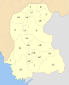 | |
| Hyderabad | ||
| Karachi | ||
| Larkana | ||
| Mirpur Khas | ||
| Shaheed Benazir Abad | ||
| Sukkur | ||
| International | |
|---|---|
| National | |
This Sindh location article is a stub. You can help Wikipedia by expanding it. |