
Lot 49, Prince Edward Island | |
|---|---|
Township | |
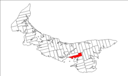 Map of Prince Edward Island highlighting Lot 49 | |
| Coordinates: 46°13′N 62°57′W / 46.217°N 62.950°W | |
| Country | Canada |
| Province | Prince Edward Island |
| County | Queens County, |
| Parish | Bedford Parish |
| Area | |
| • Total | 36.82 sq mi (95.37 km2) |
| Population (2006)[1] | |
| • Total | 1,043 |
| • Density | 28/sq mi (10.9/km2) |
| Time zone | UTC-4 (AST) |
| • Summer (DST) | UTC-3 (ADT) |
| Canadian Postal code | C0A |
| Area code | 902 |
| NTS Map | 011L02 |
| GNBC Code | BAESJ |
Lot 49 is a township in Queens County, Prince Edward Island, Canada. It is part of Bedford Parish. Lot 49 was awarded to Gabriel Christie and James Stephenson in the 1767 land lottery, and was sold to merchant Robert Clark in 1775.[2]
YouTube Encyclopedic
-
1/3Views:14 34111 198247 914
-
GGC - 36 - The 12.9km Confederation Bridge from PEI to New Brunswick
-
GGC - 34 - One Full Year In Our Van and Everything Just Keeps Working Out
-
English Listening Practice Level 4 - Learn English By Listening Engilsh With Subtitle
Transcription
References
- ^ a b Stats Canada 2001
- ^ Clark, Andrew Hill (1959). Three Centuries and the Island. Toronto Press. pp. Appendix B.
Subdivisions of Prince Edward Island | |||||||
|---|---|---|---|---|---|---|---|
| Subdivisions | |||||||
| Cities | |||||||
| Towns | |||||||
| Rural municipalities |
| ||||||
| Resort municipalities | |||||||
| Former municipalities |
| ||||||
| Unincorporated communities | |||||||
| Townships | |||||||
This Prince Edward Island location article is a stub. You can help Wikipedia by expanding it. |