
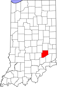
This is a list of the Indiana state historical markers in Decatur County.
This is intended to be a complete list of the official state historical markers placed in Decatur County, Indiana, United States by the Indiana Historical Bureau. The locations of the historical markers and their latitude and longitude coordinates are included below when available, along with their names, years of placement, and topics as recorded by the Historical Bureau. There are 5 historical markers located in Decatur County.[1]
Historical markers
| Marker title | Image | Year placed | Location | Topics |
|---|---|---|---|---|
| Decatur County Court House[2] | 
|
1980 | Southwestern lawn of Courthouse Square along Main Street (State Road 46 in Greensburg 39°20′13″N 85°29′1″W / 39.33694°N 85.48361°W |
Buildings and Architecture, Military |
| Civil War General John T. Wilder[3] | 
|
2001 | Northern side of 446 E. Main Street (State Road 46 at the Poplar Street junction in Greensburg 39°20′13″N 85°28′40″W / 39.33694°N 85.47778°W |
Military |
| <i>Donnell v. State</i>, 1852[4] | 2007 | 150 Courthouse Square in Greensburg 39°20′13″N 85°29′0″W / 39.33694°N 85.48333°W |
African American, Underground Railroad | |
| Escape of Caroline, 1847[5] | 2008 | 4783 E. County Road 280N near Kingston 39°22′44″N 85°23′18″W / 39.37889°N 85.38833°W |
African American, Underground Railroad, Women | |
| Carl Fisher[6] | 
|
2014 | 150 Courthouse Square, Greensburg 39°20′15″N 85°29′00″W / 39.33750°N 85.48333°W |
Transportation; Business, Industry, & Labor; Sports |
See also
- List of Indiana state historical markers
- National Register of Historic Places listings in Decatur County, Indiana
References
- ^ "Indiana Historical Markers by County". State of Indiana. Retrieved 2012-03-15.
- ^ Decatur County Court House, Indiana Historical Bureau, n.d. Accessed 2012-03-14.
- ^ Civil War General John T. Wilder, Indiana Historical Bureau, n.d. Accessed 2012-03-14.
- ^ Donnell v. State, 1852, Indiana Historical Bureau, n.d. Accessed 2012-03-14.
- ^ Escape of Caroline, 1847, Indiana Historical Bureau, n.d. Accessed 2012-03-14.
- ^ IHB (2020-12-15). "Carl Fisher". IHB. Retrieved 2024-03-13.
External links
Municipalities and communities of Decatur County, Indiana, United States | ||
|---|---|---|
| City |  | |
| Towns | ||
| Townships | ||
| CDPs | ||
| Other communities | ||
| Ghost town | ||
| Footnotes | ‡This populated place also has portions in an adjacent county or counties | |