
Washington Township | |
|---|---|
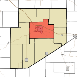 Location of Washington Township in Decatur County | |
| Coordinates: 39°20′13″N 85°28′22″W / 39.33694°N 85.47278°W | |
| Country | United States |
| State | Indiana |
| County | Decatur |
| Government | |
| • Type | Indiana township |
| • Township Trustee | Beverly Rivera |
| Area | |
| • Total | 55.24 sq mi (143.1 km2) |
| • Land | 55.07 sq mi (142.6 km2) |
| • Water | 0.17 sq mi (0.4 km2) |
| Elevation | 955 ft (291 m) |
| Population (2020) | |
| • Total | 14,053 |
| • Density | 250/sq mi (98/km2) |
| Time zone | EST |
| Area code | 812 |
| FIPS code | 18-80558[2] |
| GNIS feature ID | 453992 |
Washington Township is one of nine townships in Decatur County, Indiana. As of the 2020 census, its population was 14,053 (up from 13,304 at 2010[3]) and it contained 6,177 housing units.[4]
| Census | Pop. | Note | %± |
|---|---|---|---|
| 1890 | 5,518 | — | |
| 1900 | 6,604 | 19.7% | |
| 1910 | 6,828 | 3.4% | |
| 1920 | 6,791 | −0.5% | |
| 1930 | 7,182 | 5.8% | |
| 1940 | 7,495 | 4.4% | |
| 1950 | 8,256 | 10.2% | |
| 1960 | 9,379 | 13.6% | |
| 1970 | 11,112 | 18.5% | |
| 1980 | 11,346 | 2.1% | |
| 1990 | 11,330 | −0.1% | |
| 2000 | 12,206 | 7.7% | |
| 2010 | 13,304 | 9.0% | |
| 2020 | 14,053 | 5.6% | |
| Source: US Decennial Census[5] | |||
YouTube Encyclopedic
-
1/2Views:4011 409 937
-
Decatur, Indiana ⭐️🌎 AMERICAN CITIES 🌎⭐️
-
10 Places in Illinois You Should NEVER Move To
Transcription
History
Washington Township was organized in 1822.[6]
Strauther Pleak Round Barn was added to the National Register of Historic Places in 1993.[7]
Geography
According to the 2010 census, the township has a total area of 55.24 square miles (143.1 km2), of which 55.07 square miles (142.6 km2) (or 99.69%) is land and 0.17 square miles (0.44 km2) (or 0.31%) is water.[3]
Cities and towns
Unincorporated towns
- Craig
- Knarr Corner
- McCoy
- Middle Branch
(This list is based on USGS data and may include former settlements.)
Adjacent townships
- Clinton Township (north)
- Fugit Township (northeast)
- Salt Creek Township (east)
- Marion Township (south)
- Sand Creek Township (southwest)
- Clay Township (west)
- Adams Township (northwest)
Major highways
Cemeteries
The township contains five cemeteries: Forsythe, Saint Marys, Sand Creek, South Park and Springer.
References
- ^ "US Board on Geographic Names". United States Geological Survey. October 25, 2007. Retrieved January 31, 2008.
- ^ "U.S. Census website". United States Census Bureau. Retrieved January 31, 2008.
- ^ a b "Population, Housing Units, Area, and Density: 2010 - County -- County Subdivision and Place -- 2010 Census Summary File 1". United States Census. Archived from the original on February 12, 2020. Retrieved May 10, 2013.
- ^ "Explore Census Data". data.census.gov. Retrieved April 10, 2024.
- ^ "Township Census Counts: STATS Indiana".
- ^ Harding, Lewis Albert (1915). History of Decatur County, Indiana: Its People, Industries and Institutions. B.F. Bowen. pp. 95.
- ^ "National Register Information System". National Register of Historic Places. National Park Service. July 9, 2010.
External links
Wikimedia Commons has media related to Washington Township, Decatur County, Indiana.
Municipalities and communities of Decatur County, Indiana, United States | ||
|---|---|---|
| City |  | |
| Towns | ||
| Townships | ||
| CDPs | ||
| Other communities | ||
| Ghost town | ||
| Footnotes | ‡This populated place also has portions in an adjacent county or counties | |