
Leypi
Лейпи | |
|---|---|
Inhabited locality[1] | |
Location of Leypi  | |
 Leypi Location of Leypi 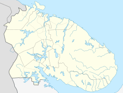 Leypi Leypi (Murmansk Oblast) | |
| Coordinates: 67°30′N 30°43′E / 67.500°N 30.717°E | |
| Country | Russia |
| Federal subject | Murmansk Oblast[1] |
| Administrative district | Kovdorsky District[1] |
| Territorial okrug | Yonsky Territorial Okrug |
| Elevation | 210 m (690 ft) |
| Population | |
| • Total | 346 |
| • Urban okrug | Kovdorsky Urban Okrug[3] |
| Time zone | UTC+3 (MSK |
| Postal code(s)[5] | 184131 |
| Dialing code(s) | +7 81535 |
| OKTMO ID | 47703000121 |
Leypi (Russian: Лейпи) is a rural locality (an inhabited locality) in Kovdorsky District of Murmansk Oblast, Russia,[1] located beyond the Arctic Circle at a height of 210 meters (690 ft) above sea level. Population: 346 (2010 Census).[2]
YouTube Encyclopedic
-
1/1Views:2 168
-
LA GRAN ESTRELLA CON NITIDO EN EL ESTUDIO.
Transcription
References
Notes
- ^ a b c d e Государственный комитет Российской Федерации по статистике. Комитет Российской Федерации по стандартизации, метрологии и сертификации. №ОК 019-95 1 января 1997 г. «Общероссийский классификатор объектов административно-территориального деления. Код 47 203 000 004», в ред. изменения №278/2015 от 1 января 2016 г.. (State Statistics Committee of the Russian Federation. Committee of the Russian Federation on Standardization, Metrology, and Certification. #OK 019-95 January 1, 1997 Russian Classification of Objects of Administrative Division (OKATO). Code 47 203 000 004, as amended by the Amendment #278/2015 of January 1, 2016. ).
- ^ a b Федеральная служба государственной статистики. Территориальный орган федеральной службы государственной статистики по Мурманской области (Мурманскстат) (Federal State Statistics Service. Territorial Branch of the Federal Statistics Service in Murmansk Oblast (Murmanskstat)) (2012). "2010. Статистический сборник "Численность, размещение и возрастно-половой состав населения Мурманской области. Итоги Всероссийской переписи населения". Том 1" [2010 Statistical Digest "Size, Distribution, and the Age and Gender Characteristics of the Population of Murmansk Oblast. Results of the All-Russian Population Census] (in Russian). Federal State Statistics Service. Archived from the original on December 22, 2012. Retrieved September 10, 2012.
- ^ Law #537-01-ZMO
- ^ "Об исчислении времени". Официальный интернет-портал правовой информации (in Russian). June 3, 2011. Retrieved January 19, 2019.
- ^ Почта России. Информационно-вычислительный центр ОАСУ РПО. (Russian Post). Поиск объектов почтовой связи (Postal Objects Search) (in Russian)
Sources
- Мурманская областная Дума. Закон №537-01-ЗМО от 2 декабря 2004 г. «О статусе муниципального образования Ковдорский район», в ред. Закона №906-01-ЗМО от 26 октября 2007 г «О внесении изменений в некоторые законодательные акты Мурманской области в связи с упразднением населённых пунктов Мурманской области». Вступил в силу 1 января 2005 г. Опубликован: "Мурманский Вестник", №234, стр. 3, 7 декабря 2004 г. (Murmansk Oblast Duma. Law #537-01-ZMO of December 2, 2004 On the Status of the Municipal Formation of Kovdorsky District, as amended by the Law #906-01-ZMO of October 26, 2007 On Amending Several Legislative Acts of Murmansk Oblast Due to the Abolition of the Inhabited Localities in Murmansk Oblast. Effective as of January 1, 2005.).
This Murmansk Oblast location article is a stub. You can help Wikipedia by expanding it. |