
| Kartsakhi Lake | |
|---|---|
 View of the lake from the Georgian side | |
 Kartsakhi Lake 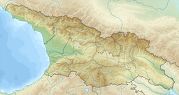 Kartsakhi Lake  Kartsakhi Lake | |
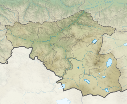
| Coordinates | 41°12′54″N 43°13′16″E / 41.21500°N 43.22111°E |
| Catchment area | 158 km2 (61 sq mi) |
| Basin countries | Georgia, Turkey |
| Surface area | 26.3 km2 (10.2 sq mi) |
| Max. depth | 1 m (3 ft 3 in) |
| Water volume | 19.3 km3 (4.6 cu mi) |
| Salinity | 880 ‰ |
| Surface elevation | 1,800 m (5,900 ft) |
 | |
Kartsakhi Lake (Georgian: კარწახის ტბა, karts'akhis tba), or Lake Khozapini (Georgian: ხოზაფინის ტბა, khozap'inis tba; Turkish: Hazapin Gölü), or Lake Aktaş (Turkish: Aktaş Gölü), is a soda lake in the Caucasus Mountains. It straddles the international border between Georgia (53%) and Turkey (47%). The village of Kartsakhi lies near the lake's northeastern shore.
It is the second largest lake in Georgia, covering an area of 26.3 or 26.6 square kilometers at an altitude of 1799 m.[1][2] It is fed by a number of creeks. During the rainy season, its excess water discharges into the Kura River.[3]
YouTube Encyclopedic
-
1/4Views:39 32191573642 168
-
End of Turkey (Ep 46 GrizzlyNbear Overland)
-
2.Аисты в Ниноцминде, Карцахи, Карская область. 1августа 2019
-
Կարծախ Ջիվանի
-
Cold War Frontline Georgia Turkey border, Sarpi,სარფის საბაჟო, aerial video footage DJI Inspire 1
Transcription
Fauna
It is an important bird habitat; it holds one of the largest populations of the Eurasian eagle-owl in the country, along with populations of the Dalmatian pelican and great white pelican.[4]
References
- ^ Hlavinek, Petr (2008). Dangerous pollutants (xenobiotics) in urban waters cycle. Springer. p. 37. ISBN 978-1-4020-6800-3. Retrieved 6 October 2011.
- ^ Prokhorov, Aleksandr Mikhaĭlovich (1982). Great Soviet encyclopedia. Macmillan. p. 195. Retrieved 6 October 2011.
- ^ Wetland page (in Turkish)
- ^ Evans, M. I.; Heath, Melanie F.; International, BirdLife (2000). Important bird areas in Europe: priority sites for conservation. BirdLife International. p. 255. ISBN 978-0-946888-35-1. Retrieved 6 October 2011.
| Eastern Georgia |
| ||||
|---|---|---|---|---|---|
| Western Georgia |
| ||||
| Natural lakes |
|
|---|---|
| Artificial lakes | |
This Georgia location article is a stub. You can help Wikipedia by expanding it. |
This Turkey location article is a stub. You can help Wikipedia by expanding it. |