
Laird, Colorado | |
|---|---|
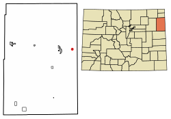 Location of the Laird CDP in Yuma County, Colorado. | |
 Laird Location of the Laird CDP in the United States. | |
| Coordinates: 40°04′54″N 102°06′07″W / 40.0818012°N 102.1018979°W[1] | |
| Country | |
| State | |
| County | Yuma County |
| Government | |
| • Type | unincorporated town |
| Area | |
| • Total | 0.150 sq mi (0.389 km2) |
| • Land | 0.150 sq mi (0.389 km2) |
| • Water | 0.000 sq mi (0.000 km2) |
| Elevation | 3,402 ft (1,037 m) |
| Population | |
| • Total | 46 |
| • Density | 310/sq mi (120/km2) |
| Time zone | UTC-7 (MST) |
| • Summer (DST) | UTC-6 (MDT) |
| ZIP Code[4] | 80758 |
| Area code | 970 |
| GNIS feature[2] | Laird CDP |
Laird is an unincorporated community and a census-designated place (CDP) located in and governed by Yuma County, Colorado, United States. The population of the Laird CDP was 46 at the United States Census 2020.[3] The Wray post office (Zip Code 80758) serves Laird postal addresses.[4] Laird has the lowest elevation of any community in Colorado at 3,402 feet (1,037 m).
Etymology
Laird has the name of James Laird, a Nebraska legislator.[5] "Laird" is the Scots language word for a "lord".
History
The Laird post office began operation in 1887.[6]
Geography
The Laird CDP has an area of 96 acres (0.389 km2), all land.[1]
Demographics
The United States Census Bureau initially defined the Laird CDP for the United States Census 2010.
| Year | Pop. | ±% |
|---|---|---|
| 2010 | 47 | — |
| 2020 | 46 | −2.1% |
| Source: United States Census Bureau | ||
See also
References
- ^ a b c "State of Colorado Census Designated Places - BAS20 - Data as of January 1, 2020". United States Census Bureau. Retrieved December 28, 2020.
- ^ a b c "U.S. Board on Geographic Names: Domestic Names". United States Geological Survey. Retrieved December 28, 2020.
- ^ a b United States Census Bureau. "Laird CDP, Colorado". Retrieved April 11, 2023.
- ^ a b "Zip Code 80758 Map and Profile". zipdatamaps.com. 2020. Retrieved December 28, 2020.
- ^ Dawson, John Frank. Place names in Colorado: why 700 communities were so named, 150 of Spanish or Indian origin. Denver, CO: The J. Frank Dawson Publishing Co. p. 30.
- ^ "Post offices". Jim Forte Postal History. Retrieved June 29, 2016.
External links
Laird, Colorado at Wikipedia's sister projects
 Definitions from Wiktionary
 Media from Commons
 News from Wikinews
 Quotations from Wikiquote
 Texts from Wikisource
 Textbooks from Wikibooks
 Resources from Wikiversity
Municipalities and communities of Yuma County, Colorado, United States | ||
|---|---|---|
| Cities |  | |
| Town | ||
| CDPs | ||
| Unincorporated community | ||
| Ghost towns | ||