
Songo - La Maya | |
|---|---|
 Main road in La Maya | |
 Seal | |
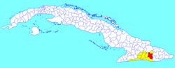 Songo - La Maya municipality (red) within Santiago Province (yellow) and Cuba | |
| Coordinates: 20°10′24″N 75°38′47″W / 20.17333°N 75.64639°W | |
| Country | Cuba |
| Province | Santiago de Cuba |
| Seat | La Maya |
| Founded | 1858 (Alto Songo)[1] |
| Incorporated | 1879 |
| Area | |
| • Total | 720.7 km2 (278.3 sq mi) |
| Elevation | 225 m (738 ft) |
| Population (2022)[2] | |
| • Total | 89,819 |
| • Density | 120/km2 (320/sq mi) |
| Time zone | UTC-5 (EST) |
| Area code | +53-226 |
| Website | https://www.songolamaya.gob.cu/ |
Songo – La Maya is a municipality in the Santiago de Cuba Province of Cuba. It is located north-east of Santiago de Cuba and is centered on the towns of La Maya (municipal seat) and Alto Songo (or Songo).
YouTube Encyclopedic
-
1/2Views:4 7232 490
-
Reportaje desde Songo - La Maya, Cuba
-
Carnavales de la maya,Santiago de cuba..
Transcription
History
In 1943, the municipality consisted of the barrios (neighbourhoods) of Florida Blanca, Jarahueca, La Maya, La Sabana, Morón, Norte Cabecera, Palenque, Socorro, Sur Cabecera and Tí Arriba.[1]
Geography
The municipality is located east of the province, neighboring the provinces of Holguín and Guantánamo; and borders with the municipalities of San Luis, Mayarí, Segundo Frente, El Salvador, Niceto Pérez and Santiago de Cuba.
It includes the town of La Maya and the villages of Alto Songo, Belleza, Bolaño, El Manguito, El Piñon, Jagua, Jarahueca, Jurisdicción, Jutinicú, La Perla, La Prueba, La Sabana, Los Reynaldos, Matahambre, Palmarejo, Río Arriba, San Benito del Crucero, Santa Cruz and Yerba de Guinea.[3]
Demographics
In 2022, the municipality of Songo – La Maya had a population of 89,819.[2] With a total area of 721 km2 (278 sq mi), it has a population density of 139.2/km2 (361/sq mi).
See also
References
- ^ a b Guije.com. "Songo - La Maya" (in Spanish). Retrieved 2007-10-05.
- ^ a b "Cuba: Administrative Division (Provinces and Municipalities) - Population Statistics, Charts and Map". www.citypopulation.de. Retrieved 2024-02-03.
- ^ 5919055 Songo–La Maya on OpenStreetMap
External links
 Media related to Songo - La Maya at Wikimedia Commons
Places adjacent to Songo – La Maya | ||||||||||||||||
|---|---|---|---|---|---|---|---|---|---|---|---|---|---|---|---|---|
| ||||||||||||||||
| International | |
|---|---|
| National | |
This Cuban location article is a stub. You can help Wikipedia by expanding it. |