
KutChap
กุดจับ | |
|---|---|
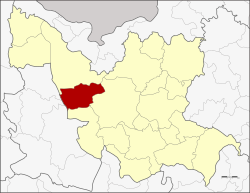 District location in Udon Thani province | |
| Coordinates: 17°25′32″N 102°34′0″E / 17.42556°N 102.56667°E | |
| Country | Thailand |
| Province | Udon Thani |
| Seat | Mueang Phia |
| Area | |
| • Total | 785.0 km2 (303.1 sq mi) |
| Population (2005) | |
| • Total | 62,301 |
| • Density | 79.4/km2 (206/sq mi) |
| Time zone | UTC+7 (ICT) |
| Postal code | 41250 |
| Geocode | 4102 |
Kut Chap (Thai: กุดจับ, pronounced [kùt t͡ɕàp]) is a district (amphoe) in the western part of Udon Thani province, northeastern Thailand.
Geography
Neighboring districts are (from the north clockwise): Ban Phue, Mueang Udon Thani and Nong Wua So of Udon Thani Province; Na Klang and Suwannakhuha of Nong Bua Lamphu province
History
The minor district (king amphoe) was created on 20 July 1972, when the three tambons, Kut Chap, Pa Kho, and Chiang Pheng, were split off from Mueang Udon Thani district.[1] It was upgraded to a full district on 8 September 1976.[2]
Administration
The district is divided into seven sub-districts (tambons), which are further subdivided into 94 villages (mubans). There are four townships (thesaban tambons), Chiang Pheng, Sang Ko, and Tan Lian each covers parts of the same-named tambons, and Kut Chap covers parts of tambons Kut Chap and Mueang Phia. There are a further seven tambon administrative organizations (TAO).
| No. | Name | Thai name | Villages | Pop. | |
|---|---|---|---|---|---|
| 1. | Kut Chap | กุดจับ | 11 | 8,818 | |
| 2. | Pa Kho | ปะโค | 14 | 8,900 | |
| 3. | Khon Yung | ขอนยูง | 14 | 8,935 | |
| 4. | Chiang Pheng | เชียงเพ็ง | 14 | 9,211 | |
| 5. | Sang Ko | สร้างก่อ | 13 | 8,377 | |
| 6. | Mueang Phia | เมืองเพีย | 15 | 12,414 | |
| 7. | Tan Lian | ตาลเลียน | 13 | 5,646 |
References
- ^ ประกาศกระทรวงมหาดไทย เรื่อง แบ่งท้องที่อำเภอเมืองอุดรธานี จังหวัดอุดรธานี ตั้งเป็นกิ่งอำเภอกุดจับ (PDF). Royal Gazette (in Thai). 89 (109 ง): 1828. July 18, 1972. Archived from the original (PDF) on February 24, 2012.
- ^ พระราชกฤษฎีกาตั้งอำเภอเลาขวัญ อำเภอคำม่วง อำเภอพิปูน อำเภอศรีเทพ อำเภอนาแห้ว อำเภอส่องดาว อำเภอควนกาหลง อำเภอค่ายบางระจัน อำเภอบ้านตาขุน และอำเภอกุดจับ พ.ศ. ๒๕๑๙ (PDF). Royal Gazette (in Thai). 93 (109 ก special): 31–34. September 8, 1976. Archived from the original (PDF) on September 27, 2007.
External links
This Udon Thani Province location article is a stub. You can help Wikipedia by expanding it. |