
Kozatske
Козацьке | |
|---|---|
 Flag  Coat of arms | |
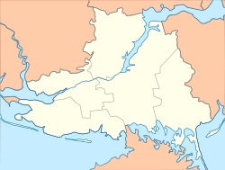 Kozatske Location in Kherson Oblast  Kozatske Location in Ukraine | |
| Coordinates: 46°47′02″N 33°20′05″E / 46.78389°N 33.33472°E | |
| Country | |
| Oblast | Kherson Oblast |
| Raion | Kakhovka Raion |
| Population (2022) | |
| • Total | |
| Time zone | UTC+2 (EET) |
| • Summer (DST) | UTC+3 (EEST) |
Kozatske (Ukrainian: Козацьке; Russian: Казацкое) is a rural settlement in Kakhovka Raion, Kherson Oblast, southern Ukraine. It is located on the right bank of the Dnieper, separated from Nova Kakhovka on the left bank by the dam of the Kakhovka Hydroelectric Power Plant. Kozatske belongs to Nova Kakhovka urban hromada, one of the hromadas of Ukraine.[1] It has a population of 3,653 (2022 estimate).[2]
History
Until 18 July, 2020, Kozatske belonged to Beryslav Raion. As part of the administrative reform of Ukraine, which reduced the number of raions of Kherson Oblast to five, it was transferred to Kakhovka Raion.[3][4]
During the Russian invasion of Ukraine, fighting took place in Kozatske and neighboring Vesele, Kakhovka Raion on 25 February 2022.[5]
Until 26 January 2024, Kozatske was designated urban-type settlement. On this day, a new law entered into force which abolished this status, and Kozatske became a rural settlement.[6]
Economy
Transportation
Kozatska railway station is on the railway connecting Mykolaiv via Snihurivka and Nova Kakhovka with Melitopol. There is infrequent passenger traffic.
The settlement has road access to Kherson and, via Nova Kakhovka, with Highway M14 connecting Kherson with Melitopol.
See also
References
- ^ "Новокаховская городская громада" (in Russian). Портал об'єднаних громад України.
- ^ Чисельність наявного населення України на 1 січня 2022 [Number of Present Population of Ukraine, as of January 1, 2022] (PDF) (in Ukrainian and English). Kyiv: State Statistics Service of Ukraine. Archived (PDF) from the original on 4 July 2022.
- ^ "Про утворення та ліквідацію районів. Постанова Верховної Ради України № 807-ІХ". Голос України (in Ukrainian). 2020-07-18. Retrieved 2020-10-03.
- ^ "Нові райони: карти + склад" (in Ukrainian). Міністерство розвитку громад та територій України.
- ^ Таміла Івановна (2022-02-26). "У Новій Каховці на Херсонщині ніч пройшла спокійно - міський голова". Suspilne. Retrieved 2024-02-23.
- ^ "Что изменится в Украине с 1 января". glavnoe.in.ua (in Russian). 1 January 2024.
| Cities |  | |
|---|---|---|
| Urban-type settlements | ||
| Villages | ||
| Hromadas |
| |