Kousba
كوسبا | |
|---|---|
City | |
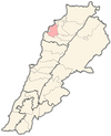
 Kousba Location within Lebanon | |
| Coordinates: 34°18′6″N 35°51′10″E / 34.30167°N 35.85278°E | |
| Country | |
| Governorate | North Governorate |
| District | Koura District |
| Highest elevation | 500 m (1,600 ft) |
| Lowest elevation | 450 m (1,480 ft) |
| Time zone | UTC+2 (EET) |
| • Summer (DST) | UTC+3 (EEST) |
| Dialing code | +961 |
Kousba (Arabic: كوسبا) is a village in Koura District, in the Northern Governorate of Lebanon. Kousba has around 5,000 residents, most of which are Greek Orthodox.[1]
YouTube Encyclopedic
-
1/3Views:2 0491 713321
-
Driving: Lebanon Road Trip: Hamatoura Monastery, Kousba, Lebanon (2017-03-19)
-
KOUSBA LEBANON- ARZ
-
Lebanon Walking Tour: From Kousba To Hamatoura Monastery, Lebanon (2021-10-10)
Transcription
Etymology
According to the elderly residents of this town, the name Kousba comes from the word "hidden" because of how it lies between mountains.[citation needed][clarification needed]
Geography
Kousba's surface is 6.02 square kilometers, with an altitude of 500 meters.[2]
Kousba is situated 18 km south of Tripoli and 12 km east of Chekka. A main road that runs from Chekka to Bsharri (called "Chekka Arz Highway") passes through Kousba.
There are many landmarks in Kousba, including ancient historical monuments, touristic attractions, religious sites,[3] sport clubs, teaching institutions and social clubs[citation needed].
Demographics
In 1953, Kousba's population was 1,732,[4] but its population has increased to about 5,000 residents.[citation needed][when?] Statistics from the 2004 municipal elections indicate that Kousba has 7,193 registered voters—of which 4,940 voted.[2]
Kousba is one of the most-inhabited villages in the Koura district.[citation needed]
Economy
There are 23 companies in Kousba that have more than five employees.[2]
Education
There were 311 students enrolled in its two public schools in 2002.[2]
Human resources
Health
Kousba has one medical center[citation needed] but no hospitals.[2]
Families in Kousba
Abdullah, Andraous, Antoun, Atieh, Awad, Ayoub, Azar, Bchara, Braheem, Chehade, Dannawi, Fadil, Farah, Fayad, Ghazi, Gosen, Greij, Habib, Hakeem, Hanna, Haykal, Ibrahim, Isaac, Israel, Jabbour, Kamar, Kanaan, Kheir, El-Khoury, Manssour, Mitri, Moussa, Nahas, Namey, Nasr, Nassar, Rihana, Roumi, Saab, Saba, Saddic, Sarkis, Sarraf, Sassine, El-Tom, Wakeem, Yacoub, Younis, Youssef, Zaidan and El Zalameh.[citation needed]
References
- ^ "Municipal and ikhtiyariah elections in Northern Lebanon" (PDF). The Monthly. March 2010. p. 23. Archived from the original on 3 June 2016. Retrieved 31 October 2016.
{{cite web}}: CS1 maint: bot: original URL status unknown (link) - ^ a b c d e "Kousba - Localiban". 2023-01-15. Archived from the original on 2023-01-15. Retrieved 2023-07-19.
- ^ "كوسبا: نفحاتٌ من التاريخ وعنوان للسياحة الدينيّة". annahar.com. Retrieved 2023-07-19.
- ^ . 2023-03-24 https://web.archive.org/web/20230324182139/https://scholarworks.aub.edu.lb/bitstream/handle/10938/3411/t-122.pdf. Archived from the original on 2023-03-24. Retrieved 2023-03-24.
{{cite web}}: Missing or empty|title=(help)CS1 maint: bot: original URL status unknown (link)
External links
- Kousba, Localiban (in English)
- Kousba, Localiban (in French)
- http://www.kousba.gov.lb Archived 2014-12-18 at the Wayback Machine
- http://www.hamatoura.com/