
Ain Akrine
عين أكرين | |
|---|---|
City | |
| Country | |
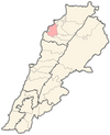
| Governorate | North Governorate |
| District | Koura District |
| Area | |
| • Total | 1.162 km2 (0.449 sq mi) |
| Population | |
| • Total | 96 |
| • Density | 83/km2 (210/sq mi) |
| Time zone | UTC+2 (EET) |
| • Summer (DST) | UTC+3 (EEST) |
| Dialing code | +961 |
Ain Akrine, Ain Aakrine, (Arabic: عين عكرين) is a Maronite village in Koura District of Lebanon.[1] It was established in the early 19th century.
History
Before the 19th century, the land on which Ain Akrine stands today, was owned by AL HAJJ Youssef from Bnehrane. Following a dispute between two brothers, the family of EL KHOURY Ibrahim migrated from Kfarshakhna and settled in Ain Akrine. During the Ottoman occupation, a group of Christians lived in this town to escape oppression. The village is also known as Nawous Town.[2]In 1953, Ain Akrine had a population of 242 living in 36 households.[3]
References
- ^ "Municipal and ikhtiyariah elections in Northern Lebanon" (PDF). The Monthly. March 2010. p. 23. Archived from the original on 3 June 2016. Retrieved 29 October 2016.
{{cite web}}: CS1 maint: bot: original URL status unknown (link) - ^ Ain Akrine Website - History
- ^ Sawaya, Salah Michel (March 1953). Household Income and Expenditure in Al-Kura, Lebanon (PDF). Scholarworks (M.A.). Beirut, Lebanon: Economics Dept., American University of Beirut, Lebanon. hdl:10938/3411. Archived from the original (PDF) on 24 March 2023. Retrieved 2023-03-24.
External links
- Ain Aakrine, Localiban
34°17′08″N 35°50′48″E / 34.2856°N 35.8467°E
This Lebanon location article is a stub. You can help Wikipedia by expanding it. |