Kostromka
Костромка | |
|---|---|
| Coordinates: 47°08′17″N 33°08′59″E / 47.138056°N 33.149722°E | |
| Country | |
| Oblast | Kherson Oblast |
| Raion | Beryslav Raion |
| Area | |
| • Total | 1.278 km2 (0.493 sq mi) |
| Elevation | 66 m (217 ft) |
| Population | |
| • Total | 181 |
| • Density | 140/km2 (370/sq mi) |
| Time zone | UTC+2 (EET) |
| • Summer (DST) | UTC+3 (EEST) |
| Postal code | 74121 |
| Area code | +380 5532 |
 | |
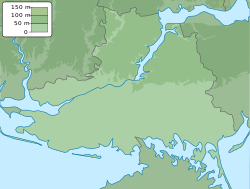
Kostromka (Ukrainian: Костромка; Russian: Костромка) is a village in Beryslav Raion (district) in Kherson Oblast of southern Ukraine, at about 75.6 kilometres (47.0 mi) northeast by north from the centre of Kherson city.
The village came under attack by Russian forces in 2022, during the Russian invasion of Ukraine.[2]
References
- ^ "Distribution of the population by native language on ukrcensus.gov.ua". Archived from the original on 31 July 2014. Retrieved 7 September 2022.
- ^ Kateryna Stepanenko; Grace Mappes; Layne Philipson; Frederick W. Kagan (4 September 2022). "Russian Offensive Campaign Assessment, September 4". understandingwar.org. ISW. Retrieved 7 September 2022.
The Ukrainian General Staff also reported Russian airstrikes on Sukhy Stavok, Bezimenne and Kostromka, and other settlements around the Ukrainian bridgehead over the Inhulets River, which may indicate that Ukrainian forces have advanced up to 12km southeast of the bridgehead.


