
Konkyan Township
ကုန်းကြမ်းမြို့နယ် | |
|---|---|
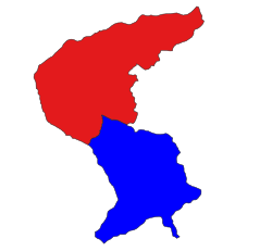 Location in Laukkaing district (Kokang SAZ) | |
 Konkyan Township Location in Myanmar | |
| Coordinates: 23°49′00″N 98°32′00″E / 23.81667°N 98.53333°E | |
| Country | |
| State | Shan State |
| Self-administered zone | Kokang |
| Area | |
| • Total | 414.33 sq mi (1,073.11 km2) |
| Elevation | 5,189 ft ([1] m) |
| Highest elevation | 8,317 ft (2,535 m) |
| Population (2019)[1] | |
| • Total | 44,898 |
| • Density | 110/sq mi (42/km2) |
| • Ethnicities | |
| Time zone | UTC+6.30 (MMT) |
Konkyan Township or Kongyan Township (Burmese: ကုန်းကြမ်းမြို့နယ်, Chinese: 拱掌区) is a township located within Laukkaing District, Shan State, Myanmar. It is one of two townships of the Kokang Self-Administered Zone. The principal town is Konkyan. The township is divided into 141 villages organized into 8 village tracts and 2 towns, each with 3 urban wards. Besides Konkyan, the other town is Mawhtike in the northeast of the township.[1]
Geography
It is sharing a border with Laukkaing Township. It is situated at 5,226 feet (1,593 m) above sea level. The remaining area is mainly mountainous with its highest point at 8,317 feet (2,535 m) above sea level.[2][1]
Rubber, lychee, mango, walnut and pear are grown in this area as poppy substitutes. Sugarcane, pineapple, corn, buckwheat, soybean and various vegetables are also grown.
Further reading
- Topo Map of Kokang Self-Administered Zone - Mimu
- Shan (North) State, Myanmar - Mimu
- Konkyan Township - Shan State - Mimu
References
- ^ a b c d Myanmar Information Management Unit (September 2019). Konkyan Myone Daethasaingyarachatlatmya ကုန်းကြမ်းမြို့နယ် ဒေသဆိုင်ရာအချက်လက်များ [Konkyan Township Regional Information] (PDF) (Report). MIMU. Retrieved 18 November 2023.
- ^ MG Archived 2011-10-02 at the Wayback Machine
This Shan State location article is a stub. You can help Wikipedia by expanding it. |

