
Khok Charoen
โคกเจริญ | |
|---|---|
District | |
 District location in Lopburi province | |
| Coordinates: 15°22′58″N 100°49′21″E / 15.38278°N 100.82250°E | |
| Country | Thailand |
| Province | Lopburi |
| Seat | Khok Charoen |
| Area | |
| • Total | 317.1 km2 (122.4 sq mi) |
| Population (31 March 2004) | |
| • Total | 24,321 |
| • Density | 76.7/km2 (199/sq mi) |
| Time zone | UTC+7 (ICT) |
| Postal code | 15250 |
| Geocode | 1609 |
Khok Charoen (Thai: โคกเจริญ, pronounced [kʰôːk t͡ɕā.rɤ̄ːn]) is a district (amphoe) of Lopburi province, central Thailand.
History
The minor district (king amphoe) was created on 9 March 1987 by splitting off four tambons from Khok Samrong district.[1] It was upgraded to full district status on 4 November 1993.[2]
Geography
Neighboring districts are (from the north clockwise) Phaisali of Nakhon Sawan province, Wichian Buri and Si Thep of Phetchabun province, Chai Badan, Sa Bot, and Nong Muang of Lopburi Province.
Administration
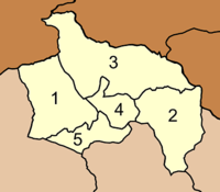
The district is divided into five sub-districts (tambons), which are further subdivided into 53 villages (mubans). There are no municipal (thesaban) areas, and a further five tambon administrative organizations (TAO).
|
|
References
- ^ "ประกาศกระทรวงมหาดไทย เรื่อง แบ่งเขตท้องที่อำเภอโคกสำโรง จังหวัดลพบุรี ตั้งเป็นกิ่งอำเภอโคกสำโรง" (PDF). Royal Gazette (in Thai). 104 (45 ง): 1753. March 12, 1987., corrected with แก้คำผิด ประกาศกระทรวงมหาดไทย เรื่อง แบ่งเขตท้องที่อำเภอโคกสำโรง จังหวัดลพบุรี ตั้งเป็นกิ่งอำเภอโคกเจริญ (PDF). Royal Gazette (in Thai). 104 (97 ง): 3595. May 26, 1987.
- ^ พระราชกฤษฎีกาตั้งอำเภอลำทับ อำเภอร่องคำ อำเภอเวียงแหง อำเภอนาโยง อำเภอแก้งสนามนาง อำเภอโนนแดง อำเภอบ้านหลวง อำเภอกะพ้อ อำเภอศรีบรรพต อำเภอแก่งกระจาน อำเภอหนองสูง อำเภอสบเมย อำเภอเมยวดี อำเภอโคกเจริญ อำเภอทุ่งหัวช้าง อำเภอผาขาว อำเภอวังหิน อำเภอดอนพุด อำเภอบึงโขงหลง และอำเภอห้วยคต พ.ศ. ๒๕๓๖ (PDF). Royal Gazette (in Thai). 110 (179 ก special): 1–3. November 3, 1993. Archived from the original (PDF) on February 24, 2012.
External links
- http://www.khokjaroen.com (Thai only)
- amphoe.com

This Lopburi Province location article is a stub. You can help Wikipedia by expanding it. |