
Kaitago-Tabasaransky okrug
Кайтаго-Табасаранскій округъ | |
|---|---|
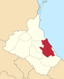 Location in the Dagestan Oblast | |
| Country | Russian Empire |
| Viceroyalty | Caucasus |
| Oblast | Dagestan |
| Established | 1860 |
| Abolished | 1928 |
| Capital | Madzhalis |
| Area | |
| • Total | 3,296.44 km2 (1,272.76 sq mi) |
| Population (1916) | |
| • Total | 82,154 |
| • Density | 25/km2 (65/sq mi) |
| • Urban | 27.50% |
| • Rural | 72.50% |
The Kaytago-Tabasaransky okrug[a] was a district (okrug) of the Dagestan Oblast of the Caucasus Viceroyalty of the Russian Empire. The area of the Kaytago-Tabasaransky okrug is included in contemporary Dagestan of the Russian Federation. The district's administrative centre was Madzhalis.[1]
Administrative divisions
The subcounties (uchastoks) of the Kaytago-Tabasaransky okrug were as follows:[2]
| Name | 1912 population | Area |
|---|---|---|
| Nizhne-Kaytagskiy uchastok (Нижне-Кайтагскій участокъ) | 20,147 | 1,151.50 square versts (1,310.48 km2; 505.98 sq mi) |
| Severo-Tabasaranskiy uchastok (Сѣверо-Табасаранскій участокъ) | 26,481 | 977.86 square versts (1,112.87 km2; 429.68 sq mi) |
| Urkarakhskiy uchastok (Уркарахскій участокъ) | 32,474 | 767.18 square versts (873.10 km2; 337.11 sq mi) |
Demographics
Russian Empire Census
According to the Russian Empire Census, the Kaytago-Tabasaransky okrug had a population of 91,021 on 28 January [O.S. 15 January] 1897, including 48,284 men and 42,737 women. The plurality of the population indicated Dargin to be their mother tongue, with significant Tatar[b] and Kazikumukh speaking minorities.[5]
| Language | Native speakers | % |
|---|---|---|
| Dargin | 33,186 | 36.46 |
| Tatar[b] | 28,975 | 31.83 |
| Kazi-Kumukh | 17,678 | 19.42 |
| Jewish | 3,965 | 4.36 |
| Russian | 2,255 | 2.48 |
| Kumyk | 1,035 | 1.14 |
| Ukrainian | 790 | 0.87 |
| Armenian | 665 | 0.73 |
| Avar-Andean | 628 | 0.69 |
| Tat | 520 | 0.57 |
| Polish | 415 | 0.46 |
| Kyurin | 350 | 0.38 |
| Lithuanian | 249 | 0.27 |
| Persian | 86 | 0.09 |
| German | 52 | 0.06 |
| Georgian | 41 | 0.05 |
| Belarusian | 18 | 0.02 |
| Nogai | 1 | 0.00 |
| Other | 112 | 0.12 |
| TOTAL | 91,021 | 100.00 |
Kavkazskiy kalendar
According to the 1917 publication of Kavkazskiy kalendar, the Kaytago-Tabasaransky okrug had a population of 113,322 on 14 January [O.S. 1 January] 1916, including 61,849 men and 51,473 women, 98,837 of whom were the permanent population, and 14,485 were temporary residents:[6]
| Nationality | Urban | Rural | TOTAL | |||
|---|---|---|---|---|---|---|
| Number | % | Number | % | Number | % | |
| North Caucasians | 5,138 | 16.48 | 78,978 | 96.13 | 84,116 | 74.23 |
| Russians | 7,567 | 24.28 | 1,580 | 1.92 | 9,147 | 8.07 |
| Jews | 6,879 | 22.07 | 1,316 | 1.60 | 8,195 | 7.23 |
| Shia Muslims[c] | 7,919 | 25.41 | 193 | 0.23 | 8,112 | 7.16 |
| Armenians | 2,604 | 8.35 | 37 | 0.05 | 2,641 | 2.33 |
| Sunni Muslims[d] | 1,061 | 3.40 | 0 | 0.00 | 1,061 | 0.94 |
| Other Europeans | 0 | 0.00 | 50 | 0.06 | 50 | 0.04 |
| TOTAL | 31,168 | 100.00 | 82,154 | 100.00 | 113,322 | 100.00 |
Notes
- ^
- Russian: Кайта́го-Табасара́нский о́круг, pre-reform orthography: Кайта́го-Табасара́нскій о́кругъ, romanized: Kaytágo-Tabasaránsky ókrug
- ^ a b Before 1918, Azerbaijanis were generally known as "Tatars". This term, employed by the Russians, referred to Turkic-speaking Muslims of the South Caucasus. After 1918, with the establishment of the Azerbaijan Democratic Republic and "especially during the Soviet era", the Tatar group identified itself as "Azerbaijani".[3][4]
- ^ Primarily Tatars.[7]
- ^ Primarily Turco-Tatars.[7]
References
- ^ Tsutsiev 2014.
- ^ Кавказский календарь на 1913 год, pp. 144–151.
- ^ Bournoutian 2018, p. 35 (note 25).
- ^ Tsutsiev 2014, p. 50.
- ^ a b "Демоскоп Weekly - Приложение. Справочник статистических показателей". www.demoscope.ru. Retrieved 2022-07-07.
- ^ Кавказский календарь на 1917 год, pp. 186–193.
- ^ a b Hovannisian 1971, p. 67.
Bibliography
- Bournoutian, George A. (2018). Armenia and Imperial Decline: The Yerevan Province, 1900–1914. Milton Park, Abingdon, Oxon: Routledge. ISBN 978-1-351-06260-2. OCLC 1037283914.
- Hovannisian, Richard G. (1971). The Republic of Armenia: The First Year, 1918–1919. Vol. 1. Berkeley: University of California Press. ISBN 978-0520019843.
- Кавказский календарь на 1913 год [Caucasian calendar for 1913] (in Russian) (68th ed.). Tiflis: Tipografiya kantselyarii Ye.I.V. na Kavkaze, kazenny dom. 1913. Archived from the original on 19 April 2022.
- Кавказский календарь на 1917 год [Caucasian calendar for 1917] (in Russian) (72nd ed.). Tiflis: Tipografiya kantselyarii Ye.I.V. na Kavkaze, kazenny dom. 1917. Archived from the original on 4 November 2021.
- Tsutsiev, Arthur (2014). Atlas of the Ethno-Political History of the Caucasus (PDF). Translated by Nora Seligman Favorov. New Haven: Yale University Press. ISBN 9780300153088. Archived (PDF) from the original on 17 June 2023.
42°07′29″N 47°50′00″E / 42.12472°N 47.83333°E