
Karatau
Қаратау Qaratau | |
|---|---|
 | |
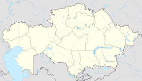 Karatau Location in Kazakhstan | |
| Coordinates: 43°10′N 70°27′E / 43.167°N 70.450°E | |
| Country | |
| Region | Jambyl Region |
| Settlement | 1963 |
| Government | |
| • Akim (mayor) | Madibek Kanatbek Kaishybekovich |
| Population (2019) | |
| • Total | 27,667 |
| Time zone | UTC+6 |
| Postal code | 080800-080803 |
| Area code | +7 72644 |
Karatau (Kazakh: Қаратау, Qaratau) is an administrative center in the Talas region located in the Jambyl Region in the south of Kazakhstan. It has an estimated population of roughly 30,000 in 1999.[1] As of 2019[update], the population is now 27,667.[2] The largest city from Karatau, Taraz, is approximately 100 km to the southwest.
YouTube Encyclopedic
-
1/2Views:32 508953
-
Karatau
-
TARAS SHEVCHENKO: POET, ARTIST, ICON 1814-1861 (Centennial Exhibition)
Transcription
Name
The name Karatau means Black Mountain in the Kazakh language. Karatau was named after the Karatau Mountain range which it is located next to and was famous during the Soviet era for phosphate.
As part of the de-russification of the Kazakh language, Karatau will be re-written with Latin scripts in 2025 and spelled Qaratau.[3]
Ghost Town

Krisha KZ reported on Karatau describing this town as a ghost town in December, 2019. The value of apartments in Karatau, according to Krisha, was between $3300–$11,500 USD.[4]
Economy
Industry
During the Soviet Union times, the main functioning industrial enterprise in the town was the phosphorite factory.
Transportation
Karatau is connected by railway with Taraz. There is also a bus and private taxi services to Taraz.
Geography
Karatau is located along a mountain range, a northwest spur of the Tien-Shan. Length, about 420 km (260 mi); maximum altitude, 2,176 m (7,139 ft) at Mount Bessaz. The range is composed of shale, sandstone, and a considerable amount of limestone and dolomite, in which karst formations are well developed. The mountains have flattened tops and steep slopes and are covered with steppe vegetation and mountain xerophytes. There are important deposits of phosphorites.[5]
Climate
Karatau has a cold semi-arid climate (Köppen climate classification BSk) with strong continental influences. It has a mean January temperature of −5 °C (23 °F) and a mean July temperature of 26.5 °C (79.7 °F).
| Climate data for Karatau | |||||||||||||
|---|---|---|---|---|---|---|---|---|---|---|---|---|---|
| Month | Jan | Feb | Mar | Apr | May | Jun | Jul | Aug | Sep | Oct | Nov | Dec | Year |
| Mean daily maximum °C (°F) | 0 (32) |
2 (36) |
11 (52) |
20 (68) |
28 (82) |
32 (90) |
35 (95) |
32 (90) |
27 (81) |
19 (66) |
9 (48) |
1 (34) |
18 (65) |
| Mean daily minimum °C (°F) | −10 (14) |
−7 (19) |
−1 (30) |
6 (43) |
11 (52) |
16 (61) |
18 (64) |
16 (61) |
10 (50) |
2 (36) |
−4 (25) |
−8 (18) |
4 (39) |
| Average precipitation mm (inches) | 25 (1.0) |
27 (1.1) |
30 (1.2) |
35 (1.4) |
25 (1.0) |
10 (0.4) |
5 (0.2) |
5 (0.2) |
5 (0.2) |
15 (0.6) |
25 (1.0) |
35 (1.4) |
242 (9.7) |
| Source: Svali.ru[6] | |||||||||||||
See also
References
- ^ "AmerasianWorld.com's Karatau, Kazakhstan". Kevin Miller, Jr.
- ^ "Population of Karatau". all-populations.com.
- ^ "Following The Trend: Kazakhstan's Planned Alphabet Change – Analysis". Keith Harrington. 10 January 2019.
- ^ "Жанатас и Каратау – города-призраки? Заброшенные города РК". Krisha KZ. Archived from the original on 2021-12-21.
- ^ "Karatau-Free Dictionary".
- ^ "Svali.ru" (in Russian). Retrieved May 8, 2012.
External links
- AmerasianWorld.com's Karatau, Kazakhstan, (Black Mountain)
- Photos of Karatau
- Karatau, Kazakhstan - Facebook Pages
- Karatay Malenkii Gorod Boshix Nadezhd (in Russian)
Capital: Taraz | ||
| Districts |  | |
| Major cities | ||