
Körösladány | |
|---|---|
 Flag  Coat of arms | |
 Körösladány | |
| Coordinates: 46°57′50″N 21°04′44″E / 46.964°N 21.079°E | |
| Country | |
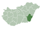
| County | Békés |
| District | Szeghalom |
| Area | |
| • Total | 123.87 km2 (47.83 sq mi) |
| Population (2015) | |
| • Total | 4,557[1] |
| • Density | 36.8/km2 (95/sq mi) |
| Time zone | UTC+1 (CET) |
| • Summer (DST) | UTC+2 (CEST) |
| Postal code | 5516 |
| Area code | (+36) 66 |
| Website | www |
Körösladány is a town in Békés County, in the Southern Great Plain region of south-east Hungary. Körösladány is located along the Crișul Repede.
Béla Wenckheim, a Hungarian politician, who served as the Prime Minister of Hungary in 1875, was born here.
Jews lived in the city in the 19th and 20th centuries until the German Nazis destroyed the Jewish community in the Holocaust.[2]
Geography
It covers an area of 123.87 km2 and has a population of 4557 people (2015).[1]
Politics
The current mayor of Körösladány is Károly Kardos (Fidesz-KDNP).
The local Municipal Assembly has 6+1 members divided into this political parties and alliances:[3]
| Party | Seats | 2014 Council | ||||
|---|---|---|---|---|---|---|
| Independent | 4 | |||||
| Fidesz-KDNP | 1 | |||||
| Movement for a Better Hungary (Jobbik) | 1 | |||||
References
- ^ a b Gazetteer of Hungary, 1st January 2015. Hungarian Central Statistical Office. 3 September 2015
- ^ Census of Hungarian Jewry
- ^ "Körösladány - képviselőtestület". Archived from the original on 23 October 2016. Retrieved 23 October 2016.
External links
- Official website in Hungarian
| Towns (4) |
| |
|---|---|---|
| Villages (3) | ||
| City with county rights |
|   |
|---|---|---|
| Towns | ||
| Large villages | ||
| Villages |
| |
| Other topics |
| |
46°58′N 21°05′E / 46.967°N 21.083°E
| International | |
|---|---|
| National | |
This Békés County location article is a stub. You can help Wikipedia by expanding it. |