
| Jelai-Bila River Sungai Jelai, Sungai Jelai-Bila, Sungai Djelai, Jelai | |
|---|---|
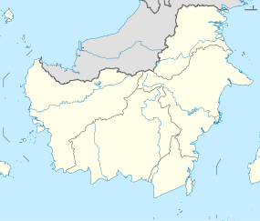 Location of river mouth  Jelai-Bila River (Indonesia) | |
| Location | |
| Country | Indonesia |
| Physical characteristics | |
| Source | |
| • location | Kalimantan |
| Mouth | Java Sea |
The Jelai-Bila River is a river of Central Kalimantan, Indonesia, about 600 km northeast of the capital Jakarta.[1] Much of the land between the Lamandau River and the Jelai-Bila River is developed by agriculture.[2]
YouTube Encyclopedic
-
1/3Views:1 520 8904802 053 354
-
LUTANG KAMING LAHAT | Geo Ong
-
Nile River = Life of Egypt | Hymn to the Nile Part 1
-
Sajek Tour 4K | Episode 05 | মেঘের রাজ্য সাজেক ভ্যালি | Sajek Valley Travel Guide | Travel Vlog
Transcription
Geography
The river flows in the central south of Borneo with a predominantly tropical monsoon climate (designated as Am in the Köppen-Geiger climate classification).[3] The annual average temperature in the area is 24 °C. The warmest month is September when the average temperature is around 26 °C, and the coldest is January, at 20 °C.[4] The average annual rainfall is 2760 mm. The wettest month is December, with an average of 531 mm of rainfall, and the driest is September, with 45 mm of rainfall.[5]
See also
References
- ^ Sungai Jelai at Geonames.org (cc-by); Last updated 2013-06-04; Database dump downloaded 2015-11-27
- ^ H. D. Rijksen; E. Meijaard (1999). Our vanishing relative: the status of wild orang-utans at the close of the twentieth century. Springer. pp. 209–210. ISBN 0-7923-5754-X.
- ^ Peel, M C; Finlayson, B L; McMahon, T A (2007). "Updated world map of the Köppen-Geiger climate classification". Hydrology and Earth System Sciences. 11 (5): 1633–1644. Bibcode:2007HESS...11.1633P. doi:10.5194/hess-11-1633-2007. Retrieved 30 January 2016.
- ^ "NASA Earth Observations Data Set Index". NASA. 30 January 2016. Archived from the original on 6 August 2013. Retrieved 8 February 2019.
- ^ "NASA Earth Observations: Rainfall (1 month - TRMM)". NASA/Tropical Rainfall Monitoring Mission. 30 January 2016. Archived from the original on 19 April 2019. Retrieved 8 February 2019.
2°59′15″S 110°43′54″E / 2.9876°S 110.73178°E