
Jantedhunga
जन्तेढुङ्गा गाउँपालिका | |
|---|---|
 Jantedhunga Location in Province No. 1  Jantedhunga Jantedhunga (Nepal) | |
| Coordinates: 26°58′00″N 86°53′00″E / 26.966667°N 86.883333°E | |
| Province | Province No. 1 |
| District | Khotang |
| Wards | 6 |
| Established | 10 March 2017 |
| Seat | Chisapani |
| Government | |
| • Type | Government CouncilVillage Council |
| • Chief Of Village Council | Mr. Shankar Bahadur Rai (NCP) |
| • Deputy Chief --> | Mrs. Bimala Rai (NCP) |
| Area | |
| • Total | 128.62 km2 (49.66 sq mi) |
| Population (2011) | |
| • Total | 15,444 |
| • Density | 120/km2 (310/sq mi) |
| Time zone | UTC+5:45 (Nepal Standard Time) |
| Website | official website |
Jantedhunga (Nepali: जन्तेढुङ्गा गाउँपालिका) is a rural municipality (gaunpalika) out of eight rural municipality located in Khotang District of Province No. 1 of Nepal. There are a total of 10 municipalities in Khotang in which 2 are urban and 8 are rural.
According to Ministry of Federal Affairs and Local Developme Jantedhunga has an area of 128.62 square kilometres (49.66 sq mi) and the total population of the municipality is 15444 as of Census of Nepal 2011.[1][2]
Kaule, Chisapani, Damarkhu Shivalaya, Diplung, Devisthan, Khotang and Wopung which previously were all separate Village development committee merged to form this new local level body. Fulfilling the requirement of the new Constitution of Nepal 2015, Ministry of Federal Affairs and Local Development replaced all old VDCs and Municipalities into 753 new local level body (Municipality).[1]
The rural municipality is divided into total 6 wards and the headquarter of this newly formed rural municipality is situated in Chisapani.[1]
YouTube Encyclopedic
-
1/3Views:1 0495 537633
-
खाेटाङ जन्तेढुङ्गा बृत्तचित्र। पाैराणिक एेतिहासिक धार्मिक तथा पर्यटकीय स्थल । Jantedhunga ,Khotang.
-
JANTEDHUNGA हुँदै चिसापानी KHOTANG यात्रा// CHISAPANI बजार जांदै// Village Trip
-
Diprung chuichumma Gaupalika under construction building
Transcription
References
- ^ a b c "स्थानीय तहहरुको विवरण". www.mofald.gov.np/en. MoFALD. Archived from the original on 31 August 2018. Retrieved 17 April 2018.
- ^ "CITY POPULATION – statistics, maps & charts". www.citypopulation.de. 8 October 2017. Retrieved 17 April 2018.
External links
Headquarters: Diktel | ||
| Urban municipalities | 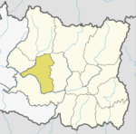 | |
| Rural municipalities | ||
For former VDCs See here | ||
This article about a location in Khotang District, Nepal is a stub. You can help Wikipedia by expanding it. |