
Isetskoye
Исетское | |
|---|---|
 General view | |
Location of Isetskoye  | |
 Isetskoye Location of Isetskoye 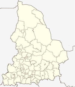 Isetskoye Isetskoye (Sverdlovsk Oblast) | |
| Coordinates: 56°27′13.38″N 61°31′24.99″E / 56.4537167°N 61.5236083°E | |
| Country | Russia |
| Federal subject | Sverdlovsk Oblast |
| Administrative district | Kamensky District |
| Founded | 1645 |
| Elevation | 195 m (640 ft) |
| Population | |
| • Total | 173 |
| Time zone | UTC+5 (MSK+2 |
| Postal code(s)[4] | 623480 |
| OKTMO ID | 65712000336 |
Isetskoye (Russian: Исетское, Isetskoye) (up to 1930 - Temnovskoye)[5] - is a village in the Kamensky District of the southern part of the Sverdlovsk oblast, Russia.
YouTube Encyclopedic
-
1/5Views:783985455603801
-
Driving through Sverdlovsk Oblast (Russia) from Kosulino to Kamyshevo 2.01.2019 Timelapse x4
-
Driving through Sverdlovsk Oblast (Russia) from Ekaterinburg to Ayat 1.01.2019 Timelapse x4
-
Driving through Sverdlovsk Oblast (Russia) from Ekaterinburg to Ayat' 2.01.2022 Timelapse x4
-
Driving through Sverdlovsk Oblast (Russia) from Ekaterinburg to Kosulino 2.01.2019 Timelapse x4
-
Driving through Ekaterinburg (Russia) from Chkalovsky to Nizhne-Isetskoye 29.12.2018 Timelapse x4
Transcription
Geography
Isetskoye is located 90 km from Yekaterinburg. Maminskoye village administration includes it.
Through the village flows the Iset river. The plot of the Iset River has several rapids and shoals. There are several rafting routes to the Revun rapid. Rocky ridges are visible in the Eastern part of the village — outcrops of volcanic tuff (Greenstone rocks) Silurian system.[citation needed]
As the whole Sverdlovsk oblast Isetskoye is located in the time zone of Ekaterinburg. The offset from UTC is +5:00. Concerning Moscow time the time zone has a constant offset +2 hours and is designated in Russia as MSK+2.
History
Temnaya settlement was founded around 1645 on the left side of the Iset river. Villagers were engaged in farming, carting and trading grain products. In 1702 the village was burnt by Bashkirs.[citation needed] Temnaya was rebuilt in several years. First church was built in 1845. It was named by St. Nicholas. The parish school was opened on March 1886.[6] During the events of The Russian Revolution of 1905 the filial of the social democratic party was established by villagers.
The church`s building was made of wood. The Perm construction division has approved the final stone draft of the new Church in 1913. Construction work was carried out until the Russian Revolution of 1917. Funding was stopped. The priest of St. Nicholas Church was shot by bolsheviks.[7] Later the building of church was burnt and half-destroyed.
Population
|
|
Transport
There is shuttle bus #102 twice a day (from Kamensk-Uralsky to Sosnovckoe).[15] The nearest railway station is Perebor, 10 kilometers to northeast.[16]
Sightings
-
 House in merchant style (as in restoration); 2015
 -
 The current state of the Church (seen from the right bank of the Iset river); 2015
References
- ^ "Map for determining the height of the terrain and the height profile". Archived from the original on 29 December 2020.
- ^ Russian Federal State Statistics Service (2011). Всероссийская перепись населения 2010 года. Том 1 [2010 All-Russian Population Census, vol. 1]. Всероссийская перепись населения 2010 года [2010 All-Russia Population Census] (in Russian). Federal State Statistics Service.
- ^ "Об исчислении времени". Официальный интернет-портал правовой информации (in Russian). 3 June 2011. Retrieved 19 January 2019.
- ^ Почта России. Информационно-вычислительный центр ОАСУ РПО. (Russian Post). Поиск объектов почтовой связи (Postal Objects Search) (in Russian)
- ^ "Исетское село Каменского района". Retrieved 2016-03-31.
- ^ "2 марта 1886 года открыта церковно-приходская школа". Retrieved 2016-03-12.
- ^ "Николаевская церковь". Archived from the original on 2015-11-23. Retrieved 2015-11-22.
- ^ XXXI. Пермская губерния. Список населённых мест по сведениям 1869 года. Санкт-Петербург, 1875, 443 стр.
- ^ Приходы и церкви Екатеринбургской епархии: Историко-статистическое описание», Екатеринбург, 1902, — 647 стр.
- ^ Список населённых мест Пермской губернии 1904 года. Изд. Пермского Губернского земства, Пермь, 1905. 526 стр.
- ^ Список населённых мест Пермской губернии Екатеринбургского уезда 1908 года. Изд. Пермского Губернского земства, Пермь, 1908. 57 стр.
- ^ Список населённых пунктов Уральской области. Том XVI. Шадринский округ. Свердловск, 1928, 136 стр.
- ^ Данные Всероссийской переписи населения 2002 года: таблица № 02c. Численность населения и преобладающая национальность по каждому сельскому населенному пункту. М.: Федеральная служба государственной статистики, 2004
- ^ "Всероссийская перепись населения 2010 года. Численность и размещение населения Свердловской области". Archived from the original on 2014-06-01. Retrieved 2014-06-01.
- ^ "Маршрут Каменск-Уральский — Сосновское". Retrieved 2016-03-15.
- ^ "Маршрут до ж.д. станции Перебор". Retrieved 2016-03-15.