
Indian River Estates, Florida | |
|---|---|
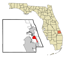 Location in St. Lucie County and the state of Florida | |
| Coordinates: 27°21′52″N 80°18′31″W / 27.36444°N 80.30861°W | |
| Country | |
| State | |
| County | St. Lucie |
| Area | |
| • Total | 5.98 sq mi (15.48 km2) |
| • Land | 5.57 sq mi (14.43 km2) |
| • Water | 0.41 sq mi (1.05 km2) |
| Elevation | 13 ft (4 m) |
| Population (2020) | |
| • Total | 6,584 |
| • Density | 1,182.05/sq mi (456.39/km2) |
| Time zone | UTC-5 (Eastern (EST)) |
| • Summer (DST) | UTC-4 (EDT) |
| FIPS code | 12-33585[2] |
| GNIS feature ID | 1867156[3] |
Indian River Estates is a census-designated place (CDP) in St. Lucie County, Florida, United States. The population was 6,220 at the 2010 census. It is part of the Port St. Lucie Metropolitan Statistical Area.
YouTube Encyclopedic
-
1/3Views:6382 5431 496
-
13549 S Indian River Dr - 4K Video
-
Florida Condo For Sale Moody River Estates, N Ft Myers
-
1171 N. Indian River Drive | Cocoa, FL 32922 | home for sale | Indian River
Transcription
Geography
Indian River Estates is located at 27°21′52″N 80°18′31″W / 27.36444°N 80.30861°W (27.364369, -80.308620).[4]
According to the United States Census Bureau, the CDP has a total area of 5.8 square miles (15 km2), of which 5.5 square miles (14 km2) is land and 0.2 square miles (0.52 km2) (3.65%) is water.
Demographics
| Census | Pop. | Note | %± |
|---|---|---|---|
| 1990 | 4,858 | — | |
| 2000 | 5,793 | 19.2% | |
| 2010 | 6,220 | 7.4% | |
| 2020 | 6,584 | 5.9% | |
| source:[5] | |||
As of the census[2] of 2010, there were 6,220 people, 2,347 households, and 1,743 families residing in the CDP. The population density was 1,046.2 inhabitants per square mile (403.9/km2). There were 2,494 housing units at an average density of 450.4 per square mile (173.9/km2). The racial makeup of the CDP was 95.29% White, 2.31% African American, 0.19% Native American, 0.47% Asian, 0.07% Pacific Islander, 0.74% from other races, and 0.93% from two or more races. Hispanic or Latino of any race were 3.54% of the population.
There were 2,347 households, out of which 26.0% had children under the age of 18 living with them, 61.8% were married couples living together, 8.2% had a female householder with no husband present, and 25.7% were non-families. 20.1% of all households were made up of individuals, and 11.7% had someone living alone who was 65 years of age or older. The average household size was 2.45 and the average family size was 2.78.
In the CDP, the population was spread out, with 21.1% under the age of 18, 5.2% from 18 to 24, 24.4% from 25 to 44, 25.6% from 45 to 64, and 23.8% who were 65 years of age or older. The median age was 44 years. For every 100 females, there were 95.8 males. For every 100 females age 18 and over, there were 92.8 males.
The median income for a household in the CDP was $37,053, and the median income for a family was $40,790. Males had a median income of $28,857 versus $22,169 for females. The per capita income for the CDP was $16,824. About 6.4% of families and 7.7% of the population were below the poverty line, including 12.2% of those under age 18 and 2.6% of those age 65 or over.
References
- ^ "2020 U.S. Gazetteer Files". United States Census Bureau. Retrieved October 31, 2021.
- ^ a b "U.S. Census website". United States Census Bureau. Retrieved January 31, 2008.
- ^ "US Board on Geographic Names". United States Geological Survey. October 25, 2007. Retrieved January 31, 2008.
- ^ "US Gazetteer files: 2010, 2000, and 1990". United States Census Bureau. February 12, 2011. Retrieved April 23, 2011.
- ^ "CENSUS OF POPULATION AND HOUSING (1790-2000)". U.S. Census Bureau. Retrieved July 30, 2010.
Municipalities and communities of St. Lucie County, Florida, United States | ||
|---|---|---|
| Cities |  | |
| Towns | ||
| CDPs | ||
| Unincorporated community | ||