
Indian Hills, Colorado | |
|---|---|
 Indian Hills in 2014. | |
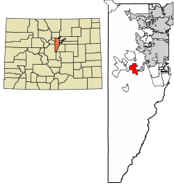 Location of the Indian Hills CDP in Jefferson County, Colorado. | |
 Indian Hills Location of the Indian Hills CDP in the United States. | |
| Coordinates: 39°37′46″N 105°15′03″W / 39.6294448°N 105.2508700°W[1] | |
| Country | |
| State | |
| County | Jefferson County |
| Government | |
| • Type | unincorporated community |
| Area | |
| • Total | 5.429 sq mi (14.060 km2) |
| • Land | 5.425 sq mi (14.051 km2) |
| • Water | 0.003 sq mi (0.009 km2) |
| Elevation | 7,211 ft (2,198 m) |
| Population | |
| • Total | 1,474 |
| • Density | 270/sq mi (100/km2) |
| Time zone | UTC-7 (MST) |
| • Summer (DST) | UTC-6 (MDT) |
| ZIP Code[4] | 80454 |
| Area codes | 303 & 720 |
| GNIS feature[2] | Indian Hills CDP |
Indian Hills is an unincorporated town, a post office, and a census-designated place (CDP) located in and governed by Jefferson County, Colorado, United States. The CDP is a part of the Denver–Aurora–Lakewood, CO Metropolitan Statistical Area. The Indian Hills post office has the ZIP code 80454.[4] At the United States Census 2020, the population of the Indian Hills CDP was 1,474.[3]
YouTube Encyclopedic
-
1/3Views:620365291 347
-
Indian Hills Colorado.mp4
-
Bigfoot is here with MrDuffy81 in Colorado, We start in Indian Hills and end up at the Platte River
-
Colorado Experience: The Original Coloradans
Transcription
History
John D. Parmalee (1813–1885) came to Colorado in 1860 and settled in Mount Vernon. In 1866, he was granted a charter for a toll road between Morrison and Bradford Junction (Conifer); the Denver and Turkey Creek Toll Road opened in 1870. Parmalee also operated sawmills and shingle mills in the area. He was later commissioned to build a road from Turkey Creek to Bergen Park, along what is known as Parmalee Gulch.[5][6]
In 1885, Parmalee sold his interest in the toll road to Benjamin F. Eden (1848–1932), who became tollgate keeper from 1877 to 1883. In 1886, Eden sold the road to Jefferson County. Eden bought properties in the northern end of Parmalee Gulch, which became known as Eden Park. In time he acquired more than 1,000 acres (4.0 km2), attracting the interest of developers. With the Panic of 1893 and crash in silver prices, the development foundered and Eden recovered the property. He continued to farm the area, raising cattle, horses, hay, and potatoes.[6]
George W. Olinger, son of mortuary founders John and Emma Olinger, became interested in the area in 1918, and purchased the Eden property in 1921. Olinger planned a development to be called "Indian Hills," and built a golf course on part of Eden's land. The first filing was recorded at Jefferson County in June 1923, making Indian Hills the community's official name. Filings were named to recall the association with original inhabitants: Arrowhead Park, Ute & Cherokee Village, and Shawnee Village. "Eden Park" became the fifth filing of Olinger's development, and was platted in 1926. Models of summer cabins were built of logs, and small lots were sold to Denver residents seeking summer homes in the mountains.[6]
Geography
Indian Hills extends along the Parmalee Gulch and Myers Gulch Roads between State Highway 74 at Kittredge, Colorado, and U.S. Highway 285 at Turkey Creek.
The Indian Hills CDP has an area of 3,474 acres (14.060 km2), including 2.2 acres (0.009 km2) of water.[1]
Demographics
The United States Census Bureau initially defined the Indian Hills CDP for the United States Census 2000.
| Year | Pop. | ±% |
|---|---|---|
| 2000 | 1,197 | — |
| 2010 | 1,280 | +6.9% |
| 2020 | 1,474 | +15.2% |
| Source: United States Census Bureau | ||
Education
Indian Hills is served by the Jefferson County Public Schools.[7] Schools serving Indian Hills include:
- Parmalee Elementary School[8]
- West Jefferson Middle School[9]
- Conifer High School[10]
Humorous sign
The sign at the Indian Hills Community Center features a changing display of humorous wordplays, and has its own Facebook page.[11]
See also
- Outline of Colorado
- State of Colorado
References
- ^ a b c "State of Colorado Census Designated Places - BAS20 - Data as of January 1, 2020". United States Census Bureau. Retrieved December 18, 2020.
- ^ a b c "U.S. Board on Geographic Names: Domestic Names". United States Geological Survey. Retrieved December 18, 2020.
- ^ a b United States Census Bureau. "Indian Hills CDP, Colorado". Retrieved April 15, 2023.
- ^ a b "Look Up a ZIP Code". United States Postal Service. Retrieved December 18, 2020.
- ^ "Brief History of Indian Hills". Indian Hills, Colorado. Archived from the original on March 22, 2012. Retrieved October 27, 2011.
{{cite web}}: CS1 maint: unfit URL (link) - ^ a b c Indian Hills History Calendar, 2008, "The People." Published by the Indian Hills Improvement Association.
- ^ "Indian Hills Map" (PDF). U.S. Census Bureau. Retrieved March 29, 2020.
- ^ "Elementary Schools". Jeffco Public Schools. Retrieved March 28, 2020. - Detail map
- ^ "Middle Schools". Jeffco Public Schools. Retrieved March 28, 2020. - Detail map
- ^ "High Schools". Jeffco Public Schools. Retrieved March 28, 2020. - Detail map
- ^ "Indian Hills Community Center and Sign". Facebook.
External links
 Definitions from Wiktionary
 Media from Commons
 News from Wikinews
 Quotations from Wikiquote
 Texts from Wikisource
 Textbooks from Wikibooks
 Resources from Wikiversity
- Indian Hills Improvement Association
- Indian Hills Fire Protection District
- Indian Hills Water District
- Jefferson County website
Municipalities and communities of Jefferson County, Colorado, United States | ||
|---|---|---|
| Cities |  | |
| Towns | ||
| CDPs | ||
| Unincorporated communities | ||
| Ghost towns | ||
| Footnotes | ‡This populated place also has portions in an adjacent county or counties | |