
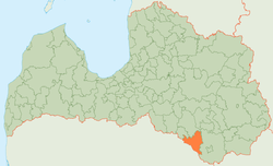
Ilūkste Municipality
Ilūkstes novads | |
|---|---|
 Flag  Coat of arms | |
 | |
| Country | |
| Formed | 2003 |
| Centre | Ilūkste |
| Government | |
| • Chairman | Stefans Rāzna (LZS) |
| Area | |
| • Total | 647.46 km2 (249.99 sq mi) |
| • Land | 632.22 km2 (244.10 sq mi) |
| • Water | 15.24 km2 (5.88 sq mi) |
| Population (2021)[2] | |
| • Total | 6,374 |
| • Density | 9.8/km2 (25/sq mi) |
| Website | www |
Ilūkste Municipality (Latvian: Ilūkstes novads) was a municipality in Selonia, Latvia. The municipality was formed in 2003 by merging Pilskalne Parish, Šēdere Parish, Bebrene Parish and Ilūkste town. In 2009 it absorbed Dviete parish, Eglaine parish and Subate town with its rural area the administrative centre being Ilūkste. In 2010 the rural area of Subate was reorganised as a separate territorial entity, Prode Parish. The population in 2020 was 6,412.[3]
On 1 July 2021, Ilūkste Municipality ceased to exist and its territory was merged into the newly-formed Augšdaugava Municipality.[4]
Demographics
Ethnic composition
As of 1 January 2010 the ethnic composition of the municipality is as follows:[5]
| Ethnic group | Number | % |
|---|---|---|
| Latvians | 5765 | 63,41 % |
| Russians | 1871 | 20,58 % |
| Poles | 770 | 8,47 % |
| Belarusians | 251 | 2,76 % |
| Lithuanians | 242 | 2,66 % |
| Others | 192 | 2,11 % |
See also
References
Wikimedia Commons has media related to Ilūkste Municipality.
- ^ Central Statistical Bureau of Latvia https://data.stat.gov.lv/pxweb/lv/OSP_PUB/START__ENV__DR__DRT/DRT010/. Retrieved 25 February 2021.
{{cite web}}: Missing or empty|title=(help) - ^ Central Statistical Bureau of Latvia https://data.stat.gov.lv/pxweb/lv/OSP_PUB/START__POP__IR__IRS/IRD060/. Retrieved 15 June 2021.
{{cite web}}: Missing or empty|title=(help) - ^ "ISG020. Population number and its change by statistical region, city, town, 21 development centres and county". Central Statistical Bureau of Latvia. 2020-01-01. Retrieved 2021-02-12.
- ^ [1] Law on Administrative Territories and Populated Areas
- ^ "Iedzīvotāju skaits pašvaldībās pēc nacionālā sastāva 01.01.2010" (PDF). Pilsonības un migrācijas lietu pārvalde. 2010-01-23. Retrieved 2010-06-26.
| National | |
|---|---|
| Geographic | |
55°59′00″N 26°18′00″E / 55.9833°N 26.3000°E