
Grand-Remous | |
|---|---|
 | |
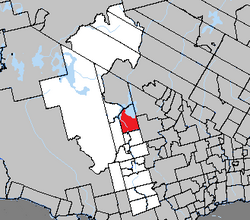 Location within La Vallée-de-la-Gatineau RCM. | |
 Grand-Remous Location in western Quebec | |
| Coordinates: 46°37′N 75°54′W / 46.617°N 75.900°W[1] | |
| Country | Canada |
| Province | Quebec |
| Region | Outaouais |
| RCM | La Vallée-de-la-Gatineau |
| Constituted | April 29, 1937 |
| Government | |
| • Mayor | Jocelyne Lyrette |
| • Federal riding | Pontiac |
| • Prov. riding | Gatineau |
| Area | |
| • Total | 509.89 km2 (196.87 sq mi) |
| • Land | 351.63 km2 (135.77 sq mi) |
| Population (2021)[3] | |
| • Total | 1,159 |
| • Density | 3.3/km2 (9/sq mi) |
| • Pop (2016–21) | |
| • Dwellings | 778 |
| Time zone | UTC−5 (EST) |
| • Summer (DST) | UTC−4 (EDT) |
| Postal code(s) | |
| Area code | 819 |
| Website | www |
Grand-Remous is a town and municipality in La Vallée-de-la-Gatineau Regional County Municipality, Quebec, Canada. The municipality is south of the Baskatong Reservoir, spanning both sides of the Gatineau River. The town is situated at the intersection of Route 117 and Route 105.
"Grand-Remous" is French for "great eddy" and is a reference to a large whirlpool on the Gatineau River near the Grand Remous Chute. This name matches the Atikamekw name "Obémiticwang", also meaning "choppy waters" or "big stir."[4]
Its territory consists of low hills which vary between 200 meters (660 ft) and 380 meters (1,250 ft) above sea level, and which are partly cleared, mostly around Grand-Remous and along highway 105.[5]
YouTube Encyclopedic
-
1/2Views:808909
-
MOST BEAUTIFUL HIKE IN QUEBEC (CANADA)? // Discovering Grand-Remous (Quebec) // Waterfalls & Trails
-
Pont rouge - Grand-Remous
Transcription
History
The township municipality, formed in 1937, was first called Sicotte, named in honour of Louis-Victor Sicotte (1812-1889), County Deputy of Saint-Hyacinthe from 1857 to 1863. The local post office was also named Sicotte in 1927, but renamed to Grand-Remous in 1933. In 1973, the municipality changed its name to conform to the name of the village where the majority of the population lived.[4]
On October 11, 2003, the Township Municipality of Grand-Remous became the Municipality of Grand-Remous.[4]
Demographics
|
| ||||||||||||||||||||||||||||||||||||||||||||||||||||||
| Includes revised count for 2001. Source: Statistics Canada[6][7] | |||||||||||||||||||||||||||||||||||||||||||||||||||||||
Private dwellings occupied by usual residents (2021): 563 (out of 778 total)[3]
Languages:
- English as first language: 5.6%
- French as first language: 90.7%
- English and French as first language: 1.6%
- Other as first language: 2.0%
References
- ^ "Banque de noms de lieux du Québec: Reference number 379142". toponymie.gouv.qc.ca (in French). Commission de toponymie du Québec.
- ^ a b "Répertoire des municipalités: Geographic code 83095". www.mamh.gouv.qc.ca (in French). Ministère des Affaires municipales et de l'Habitation.
- ^ a b c "Grand-Remous (Code 2483095) Census Profile". 2021 census. Government of Canada - Statistics Canada.
- ^ a b c "Municipalité de Canton de Grand-Remous" (in French). Commission de toponymie du Québec. Archived from the original on 2016-03-03. Retrieved 2008-08-05.
- ^ "Canton de Sicotte" (in French). Commission de toponymie du Québec. Archived from the original on 2016-03-03. Retrieved 2008-08-05.
- ^ 1996, 2001, 2006, 2011 census
- ^ "Statistics Canada - Population and dwelling count amendments to the 2001 Census". Archived from the original on 2015-10-19. Retrieved 2012-05-31.
External links
Places adjacent to Grand-Remous | |
|---|---|
| Cities | |
|---|---|
| Municipalities | |
| Townships | |
| Unorganized territories | |
| |