
Garfield, Texas | |
|---|---|
 Library and water tower | |
 | |
| Coordinates: 30°11′46″N 97°33′5″W / 30.19611°N 97.55139°W | |
| Country | United States |
| State | Texas |
| County | Travis |
| Area | |
| • Total | 12.2 sq mi (31.6 km2) |
| • Land | 12.0 sq mi (31.1 km2) |
| • Water | 0.2 sq mi (0.5 km2) |
| Elevation | 479 ft (146 m) |
| Population (2020) | |
| • Total | 1,825 |
| • Density | 150/sq mi (58/km2) |
| Time zone | UTC-6 (Central (CST)) |
| • Summer (DST) | UTC-5 (CDT) |
| ZIP code | 78617 |
| Area code | 512 & 737 |
| FIPS code | 48-28320[1] |
| GNIS feature ID | 1336402[2] |
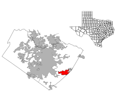
Garfield is a census-designated place (CDP) in Travis County, Texas, United States. As of the 2020 census, the CDP population was 1,825.
YouTube Encyclopedic
-
1/1Views:417
-
An Eco-Nazi Bumpkin Visits the Austin Library
Transcription
Geography
Garfield is located at 30°11′46″N 97°33′5″W / 30.19611°N 97.55139°W (30.196097, −97.551480), 12 miles (19 km) southeast of downtown Austin.
According to the United States Census Bureau in 2000, the CDP has a total area of 13.9 square miles (35.9 km2), of which 13.7 square miles (35.4 km2) was land and 0.2 square mile (0.5 km2) (1.44%) was water. Prior to the 2010 census, part of the CDP was annexed to the city of Austin, reducing its area to 12.2 square miles (32 km2), of which 12.0 square miles (31 km2) was then land and 0.2 square miles (0.52 km2) was water.[3][4]
Education
Garfield is served by the Del Valle Independent School District. The Del Valle and Hornsby-Dunlap elementary schools serve portions of the community.[5][6] For middle school students are divided between Dailey Middle School and Del Valle Middle School.[7] High school students are zoned to Del Valle High School.
The East Travis Gateway Library District operates the Garfield Library.[8]
Demographics
| Census | Pop. | Note | %± |
|---|---|---|---|
| 2000 | 1,660 | — | |
| 2010 | 1,698 | 2.3% | |
| 2020 | 1,825 | 7.5% | |
| US Decennial Census[9] 2020 Census[10] | |||
As of the census[1] of 2000, there were 1,660 people, 550 households, and 421 families residing in the CDP. The population density was 121.3 inhabitants per square mile (46.8/km2). There were 585 housing units at an average density of 42.7 per square mile (16.5/km2). The racial makeup of the CDP was 73.73% White, 2.35% African American, 0.54% Native American, 1.08% Asian, 19.46% from other races, and 2.83% from two or more races. Hispanic or Latino of any race were 32.17% of the population.
There were 550 households, out of which 37.8% had children under the age of 18 living with them, 55.8% were married couples living together, 14.0% had a female householder with no husband present, and 23.3% were non-families. 15.8% of all households were made up of individuals, and 6.4% had someone living alone who was 65 years of age or older. The average household size was 3.02 and the average family size was 3.36.
In the CDP, the population was spread out, with 30.2% under the age of 18, 9.0% from 18 to 24, 27.8% from 25 to 44, 24.3% from 45 to 64, and 8.7% who were 65 years of age or older. The median age was 33 years. For every 100 females, there were 107.8 males. For every 100 females age 18 and over, there were 111.3 males.
The median income for a household in the CDP was $48,618, and the median income for a family was $53,558. Males had a median income of $30,125 versus $25,074 for females. The per capita income for the CDP was $24,957. About 9.5% of families and 13.4% of the population were below the poverty line, including 21.9% of those under age 18 and 6.3% of those age 65 or over.
Climate
Climate is characterized by relatively high temperatures and evenly distributed precipitation throughout the year. The Köppen Climate Classification subtype for this climate is "Cfa" (Humid Subtropical Climate).[11]
| Climate data for Garfield, Texas | |||||||||||||
|---|---|---|---|---|---|---|---|---|---|---|---|---|---|
| Month | Jan | Feb | Mar | Apr | May | Jun | Jul | Aug | Sep | Oct | Nov | Dec | Year |
| Mean daily maximum °C (°F) | 16 (60) |
18 (64) |
22 (72) |
26 (79) |
29 (85) |
33 (91) |
35 (95) |
35 (95) |
32 (89) |
27 (81) |
21 (70) |
17 (63) |
26 (79) |
| Mean daily minimum °C (°F) | 4 (40) |
6 (43) |
10 (50) |
15 (59) |
19 (66) |
22 (72) |
23 (74) |
23 (74) |
21 (69) |
15 (59) |
9 (49) |
6 (42) |
14 (58) |
| Average precipitation mm (inches) | 53 (2.1) |
61 (2.4) |
53 (2.1) |
71 (2.8) |
110 (4.5) |
84 (3.3) |
41 (1.6) |
58 (2.3) |
89 (3.5) |
86 (3.4) |
61 (2.4) |
56 (2.2) |
830 (32.6) |
| Source: Weatherbase [12] | |||||||||||||
References
- ^ a b "U.S. Census website". United States Census Bureau. Retrieved January 31, 2008.
- ^ "US Board on Geographic Names". United States Geological Survey. October 25, 2007. Retrieved January 31, 2008.
- ^ "Population and Housing Unit Counts, 2010 Census of Population and Housing" (PDF). Texas: 2010.
- ^ "Garfield, Texas :: Boundary Map of Garfield, Texas".
- ^ "p448198787_8588.jpg" (Archive). Del Valle Independent School District. Retrieved on August 24, 2016.
- ^ "2010 CENSUS - CENSUS BLOCK MAP: Garfield CDP, TX." U.S. Census Bureau. Retrieved on August 24, 2016.
- ^ "2014/15 Attendance Boundaries." Del Valle Independent School District. Retrieved on August 24, 2016.
- ^ Home page. East Travis Gateway Library District. Retrieved on August 24, 2016. "Garfield Library 5121 Albert Brown Dr. Del Valle, Texas 78617"
- ^ "US Gazetteer files: 2010, 2000, and 1990". United States Census Bureau. February 12, 2011. Retrieved May 15, 2024.
- ^ "Census Bureau profile: Garfield, Texas". United States Census Bureau. May 2023. Retrieved May 15, 2024.
- ^ Climate Summary for Garfield, Texas
- ^ "Weatherbase.com". Weatherbase. 2013. Retrieved on August 15, 2013.
Municipalities and communities of Travis County, Texas, United States | ||
|---|---|---|
| Cities |  | |
| Villages | ||
| CDPs |
| |
| Other communities | ||
| Ghost towns |
| |
| Footnotes | ‡This populated place also has portions in an adjacent county or counties | |
| International | |
|---|---|
| National | |