Flying Dollar Airport | |||||||||||
|---|---|---|---|---|---|---|---|---|---|---|---|
| Summary | |||||||||||
| Airport type | Public | ||||||||||
| Owner | Flying Dollar LLC | ||||||||||
| Serves | Canadensis, Pennsylvania | ||||||||||
| Location | Monroe County | ||||||||||
| Elevation AMSL | 1,430 ft / 436 m | ||||||||||
| Coordinates | 41°12′53″N 075°14′48″W / 41.21472°N 75.24667°W | ||||||||||
| Website | www.flyingdollar.com | ||||||||||
| Map | |||||||||||
| Runways | |||||||||||
| |||||||||||
| Statistics (2016) | |||||||||||
| |||||||||||
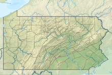
Flying Dollar Airport (FAA LID: 8N4) is a privately owned, public-use airport located two nautical miles (4 km) north of the central business district of Canadensis in Barrett Township, Monroe County, Pennsylvania, United States.[2]
YouTube Encyclopedic
-
1/3Views:4 74311 355 83496 807
-
GS: How To Get VFR Flight Following at a Non-towered Airport | While on the Ground
-
Etihad A380 The Residence Complete Flight Review
-
Traveling with Gold & Silver, Customs & TSA agents
Transcription
Facilities
Flying Dollar Airport covers an area of 70 acres (28 ha) at a maximum elevation of 1,430 feet (436 m) above mean sea level. It has one runway designated 2/20 with a turf surface measuring 2,405 by 100 feet (733 x 30.5 m).[3] It is situated 8 NM northeast of Pocono Mountains Municipal Airport (KMPO) and 23 NM east of Wilkes-Barre/Scranton International Airport (KAVP).
West of the runway, there is a private residence and one steel hangar (60 x 60 feet), erected in the 1930s and since renovated with a one-piece hydraulic door and restored to its original checkerboard roof pattern, visible from the air.
Operations
The Pennsylvania Bureau of Aviation classifies the Flying Dollar Airport as a public basic utility airport suitable for operations in daytime visual flight rules (VFR) conditions. Its runway is considered moderately challenging due to a 4.5% gradient. The southern threshold of the runway is 1,322 feet MSL while the northern threshold is 1,430 feet MSL and abuts trees that are 94 feet high. Due to these conditions, landings on runway 20 and takeoffs on runway 02 are both prohibited.[4]
The field averages 21 operations a month, 100% single-engine, rotorcraft and ultra-light aircraft. Flying Dollar is particularly popular with powered parachutes and light sport aircraft, several of which form a local consortium called The Wing Nuts, who are based on the field and arrange biannual fly-ins.[5]
History
In 1929, Barclay White and Raymond Price Sr., charter subscribers of nearby Skytop Lodge, formed a corporation and sold stock[6] to finance the creation of what was then called Barrett Airport, buying farmland from local families adjacent to the Lodge for their site. The airfield was constructed in order to provide a means of regular air service to and from the Poconos[7] and therefore to benefit Skytop Lodge, its membership, and the community at large.
The airport was renamed the Flying Dollar Airport in 1971 by Ivan L. ("Ike") Battern,[8] a Seaboard World Airlines pilot and its owner until his death in 2011.[9] Battern's widow sold the airfield at auction in 2014,[10] but it retains both its name and its status as a public basic utility airport. Flying Dollar is the oldest airport in the Pocono Mountains.
Previous owners and managers include:
- 1929: Skytop Lodges, Inc
- 1932: Charles Otto
- 1933: Lewin Barringer
- 1935: Don Nelson
- 1960s: Sky View Estates (Carl C. Riess Jr., Pres.)[11]
- 1970: Ivan L. Battern
- 2011: Andrea Battern
- 2014: Flying Dollar LLC
See also
References
- ^ FAA Airport Form 5010 for 8N4 PDF. Federal Aviation Administration. Effective April 3, 2014.
- ^ "FAA Form 5010 Master Record".
- ^ "AirNav: 8N4 - Flying Dollar Airport". www.airnav.com. Retrieved 2017-04-06.
- ^ "FAA: Airport Facilities Directory" (PDF).
- ^ Writer, ANDREW SCOTT,Pocono Record. "An 'Ultraflight' experience". poconorecord.com. Retrieved 2017-04-12.
{{cite news}}: CS1 maint: multiple names: authors list (link) - ^ "Image: Barrett Airport Inc. Capital Stock". www.flyingdollar.com. Retrieved 2017-04-06.
- ^ "Oral History: Arvella Price Magdzak". www.flyingdollar.com. Retrieved 2017-04-06.
- ^ "Writer, Rob Raikes, Pocono Record. "Flying Dollar Airport No Place to Wear Wing Tips," June 28, 1978". www.flyingdollar.com. Retrieved 2017-04-06.
- ^ "Obituary of Ivan Battern | Bolock Funeral Home & Crematory, Inc". bolockfuneralhome.com. Retrieved 2017-04-06.
- ^ Writer, Lynn Ondrusek Pocono Record. "Two part-time Pocono residents buy Flying Dollar Airport in Barrett Twp". poconorecord.com. Retrieved 2017-04-06.
- ^ "Oral History, Ivan Battern".
External links
- FAA airport information for 8N4
- AirNav airport information for 8N4
- FlightAware airport information and live flight tracker
- SkyVector aeronautical chart for 8N4
- Live weather from 8N4
- Live webcam of runway at 8N4


