
Elbert, Colorado | |
|---|---|
 Elbert, Colorado. | |
 Location of the Elbert CDP in Elbert County, Colorado. | |
 Elbert Location of the Elbert CDP in the United States. | |
| Coordinates: 39°13′08″N 104°32′26″W / 39.2188561°N 104.5404434°W[1] | |
| Country | |
| State | |
| County | Elbert County |
| Government | |
| • Type | unincorporated community |
| Area | |
| • Total | 0.474 sq mi (1.227 km2) |
| • Land | 0.474 sq mi (1.227 km2) |
| • Water | 0.000 sq mi (0.000 km2) |
| Elevation | 6,840 ft (2,085 m) |
| Population | |
| • Total | 188 |
| • Density | 400/sq mi (150/km2) |
| Time zone | UTC-7 (MST) |
| • Summer (DST) | UTC-6 (MDT) |
| ZIP Code[4] | 80106 |
| Area codes | 303 & 720 |
| GNIS feature[2] | Elbert CDP |
Elbert is an unincorporated town, a post office, and a census-designated place (CDP) located in and governed by Elbert County, Colorado, United States. The CDP is a part of the Denver–Aurora–Lakewood, CO Metropolitan Statistical Area. The Elbert post office has the ZIP Code 80106.[4] At the United States Census 2020, the population of the Elbert CDP was 188.[3]
YouTube Encyclopedic
-
1/5Views:82 8458 0192 03133 73013 270
-
Mount Elbert: Colorado's Highest Point
-
Colorado 14ers: Mt Elbert Northeast Ridge Virtual Trail Guide (Colorado's HIGHEST Peak)
-
History of Elbert County Colorado Part 1
-
Hiking our FIRST 14er and the HIGHEST point in Colorado: Mount Elbert at 14,440 ft (North Trail)
-
Hiking the Highest Peak | Colorado Fourteeners Mt. Elbert
Transcription
History
The Elbert post office has been in operation since 1875.[5] The community takes its name from Elbert County.[6]
The most significant flood events in Elbert County occurred in 1935, 1965, 1997, and 1999. The most damaging flood was in 1935, when flooding on Kiowa Creek destroyed three-fourths of the structures location in Elbert and resulted in nine deaths, seven of them in Elbert.[7] All bridges were lost, 59 buildings were destroyed, water was 8 to 15 feet (2.4 to 4.6 m) deep, and there were 5 feet (1.5 m) of sand. Three-fourths of the town of Elbert was destroyed and not rebuilt.[8]
On 11 January 1998 a fireball was seen over Elbert County. On 4 March 2000 a stone of 680.5 g was found in a field by the-five-year old Dustin Riffel on the property of his family. It was officially named "Elbert" and it was classified as an ordinary chondrite LL6.[9]
On June 15, 2009, at 1:46 p.m., a large three-quarter mile-wide, EF2 tornado touched down in rural fields west of the town. The tornado came within 2 miles (3 km) of the town at its closest. The tornado destroyed a barn at a farm and damaged an airplane hangar.[10]
Today
In Elbert today you can find a small community with a lot of ranchers and farmers. The Elbert School was rebuilt.
Geography
Elbert is located in the valley of Kiowa Creek. Elbert Road leads north 10 miles (16 km) to Kiowa and south 11 miles (18 km) to Eastonville. Colorado Springs is 37 miles (60 km) to the southwest via Elbert Road and U.S. Route 24.
During the summer, Elbert is much busier due to a nearby Boy Scout camp, Peaceful Valley Scout Ranch, which has 10,000 visitors annually. 2.8 miles (4.5 km) south of Elbert lies the JCC Ranch Camp, a Jewish camp owned by the Denver Jewish Community Center.
The Elbert CDP has an area of 303 acres (1.227 km2), all land.[1]
Demographics
The United States Census Bureau initially defined the Elbert CDP for the United States Census 2010.
| Year | Pop. | ±% |
|---|---|---|
| 2010 | 230 | — |
| 2020 | 188 | −18.3% |
| Source: United States Census Bureau | ||
Transportation
Elbert lies along Elbert Road, which connects the town of Kiowa to U.S. Highway 24. The largest nearby city is Castle Rock, which is about 45 minutes away via SH 86, which Elbert Road crosses at Kiowa. Colorado Springs is an hour drive via US 24.
See also
- Outline of Colorado
- State of Colorado
References
- ^ a b c "State of Colorado Census Designated Places - BAS20 - Data as of January 1, 2020". United States Census Bureau. Retrieved December 22, 2020.
- ^ a b c "U.S. Board on Geographic Names: Domestic Names". United States Geological Survey. Retrieved December 22, 2020.
- ^ a b United States Census Bureau. "Elbert CDP, Colorado". Retrieved April 16, 2023.
- ^ a b "Look Up a ZIP Code". United States Postal Service. Retrieved December 22, 2020.
- ^ "Post offices". Jim Forte Postal History. Archived from the original on March 6, 2016. Retrieved June 25, 2016.
- ^ Dawson, John Frank (1954). Place names in Colorado: why 700 communities were so named, 150 of Spanish or Indian origin. Denver, CO: The J. Frank Dawson Publishing Co. p. 19.
- ^ "Elbert County, Colorado - Community Website for Elbert County, Colorado". Archived from the original on January 24, 2016. Retrieved March 29, 2020.
- ^ "Elbert County, Colorado Multi-Hazard Mitigation Plan Update" (PDF). www.dhsem.state.co.us. Archived from the original (PDF) on February 1, 2016.
- ^ "Meteoritical Bulletin: Entry for Elbert". The Meteoritical Society. Retrieved June 26, 2023.
- ^ "Tornado, Funnel Clouds Menace Front Range - Denver Weather News Story - KMGH Denver". Archived from the original on June 18, 2009. Retrieved June 16, 2009.
External links
 Definitions from Wiktionary
 Media from Commons
 News from Wikinews
 Quotations from Wikiquote
 Texts from Wikisource
 Textbooks from Wikibooks
 Resources from Wikiversity
- Elbert @ Colorado.com
- Elbert @ UncoverColorado.com
- Elbert School District
- Elbert Community Bulletin Board
- Elbert County website
- Elbert County Community Homepage
Municipalities and communities of Elbert County, Colorado, United States | ||
|---|---|---|
| Towns | 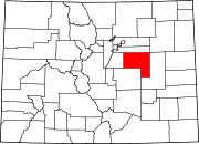 | |
| CDP | ||
| Unincorporated communities | ||
| International | |
|---|---|
| National | |