
Brasilia | |
|---|---|
city | |
 Flag  Seal | |
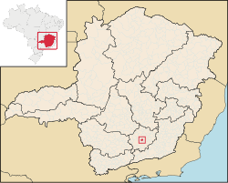 Localization in Minas Gerais | |
| Country | Brazil |
| Region | Southeast |
| State | Minas Gerais |
| Incorporated | December 17, 1938 |
| Government | |
| • Mayor | Ilídio Antonio de Melo Neto |
| Area | |
| • Total | 1,437 km2 (555 sq mi) |
| Elevation | 956 m (3,136 ft) |
| Population (2020 [1]) | |
| • Total | 10,223 |
| • Density | 71.8/km2 (186/sq mi) |
| Time zone | UTC−3 (BRT) |
| Website | Dores de Campos.com |
Dores de Campos is a Brazilian municipality. It is about 40 kilometers from São João del Rey at BR-265. About 30% of active people work in its principal factory: Marluvas.
As its neighbors cities, Dores de Campos is a point of Real Way (translated of Estrada Real).
It was founded in about 1720 and became a city on December 17, 1938.
YouTube Encyclopedic
-
1/4Views:48215 1711 099913
-
DORES DE CAMPOS MG
-
Dores de Campos, MG.
-
Homenagem aos 75 de Dores de Campos
-
Prefeitura de Dores de Campos MG – Análise de Edital
Transcription
Geography
According to IBGE (2017), the municipality is in the Immediate Geographic Region of Barbacena, in the Intermediate Geographic Region of Barbacena.[2]
Ecclesiastical circumscription
The municipality is part of the Roman Catholic Diocese of São João del-Rei.[3]
References
- ^ IBGE 2020
- ^ "Divisões Regionais do Brasil | IBGE". www.ibge.gov.br. Retrieved 2023-02-19.
- ^ Silveira, Lucas. "Diocese ganha novo mapa territorial após criação de novas foranias". Diocese de São João del Rei. Retrieved 2023-02-19.

21°06′S 44°02′W / 21.100°S 44.033°W
This geographical article relating to Minas Gerais is a stub. You can help Wikipedia by expanding it. |