
| Donuzlav | |
|---|---|
| Донузлав, Doñuzlav | |
 Donuzlav Lake near Novoozerne | |
 Donuzlav | |
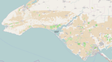
| Location | Crimea |
| Coordinates | 45°20′24″N 33°00′36″E / 45.34000°N 33.01000°E |
Lake Donuzlav (Russian and Ukrainian: Донузлав, Crimean Tatar: Doñuzlav), also referred to as Donuzlav Bay, is the deepest lake[1] of Crimea (27 m, 89 ft) and biggest in Chornomorske Raion (47 km2, 18 sq mi). It is a protected landscape and recreational park of the Autonomous Republic of Crimea.
The lake is as salty as the sea near its mouth but bottom springs make the water much less saline near the head.
YouTube Encyclopedic
-
1/5Views:4 1141 29224 2604 96227 595
-
Западный Крым. Western Crimea: from Zaozernoye to Donuzlav Lake
-
Озеро Донузлав. Первый опыт подводной съемки - Lake Donuzlav.
-
КРЫМ: Не курорт, а уникальное место на Планете Земля | Интересные факты про Крымский полуостров
-
Что в Крыму? Севастополь. Строят дороги. Заборы МИСХОРА. Южная Коса НЕПТУН и Донузлав. Капитан Крым
-
Крым. Мидийно-Устричная ферма на Донузлаве. Готовим мидии. Семеная баня в Поповке. Отдых в Крыму
Transcription
Overview
Technically it is no longer a lake but rather a bay since 1961, when a 200-metre width canal was washed through the sandy peresyp separating it from the Black Sea, when the construction of a Soviet naval base started.[2] The peresyp length is about 12 km (7.5 mi) with widths varying between 0.3 km (980 ft) to 1 km (3,300 ft).[3][1]
Donuzlav is located in Chornomorske and Saky raions (districts) at the Tarkhankut Peninsula[1] as well as Yevpatoria Municipality. Donuzlav is one of several lakes located around the peninsula.[1]
The length of Donuzlav is 30 km (19 mi), a width is up to 8.5 km (5.3 mi), an area of 42 km2 (16 sq mi) and a depth is up to 27 m (89 ft).[1] It has several small bays.[1] Banks are high, steep, and winding.[1] At separate parts of the lake, a wetland vegetation is common (i.e. common reed, cattail, others).[1]
In the upper portion of the lakes are located two dams for fish farming, in the mid portion is a naval base.[1] On the banks there is a wind-powered energy station (Sakska Wind Farm) with 53 wind turbines.[1]
To the lake are headed several gulches (semi-dried streams) among which are Staryi Donuzlav, Donuzlav, Chernushka, and Burnuk.
In the northern part there is a Donuzlav recreational park of area 2,335 hectares.
Settlements
- Novoozerne, Yevpatoria Municipality
- Myrnyi, Yevpatoria Municipality
- Ozerivka, Chornomorske Raion
- Krasnoyarske, Chornomorske Raion
Military bases

Donuzlav was the location of the Crimean Naval Base of the Soviet Union. The base was particularly notable for housing air-cushioned landing craft (Zubr class). After the dissolution of the Soviet Union it was converted into the Southern Naval Base of Armed Forces of Ukraine.
On 5 March 2014, during the Crimean crisis of 2014, Russian sailors scuttled two Russian Black Sea Fleet vessels, the anti-submarine ship Ochakov and the rescue tugboat Shakhter, at the entrance to Donuzlav Bay to prevent Ukrainian Navy ships from accessing the Black Sea[4][5][6][7] and established the Russian naval base there, reinstating its previous name.
Early on 1 February 2024, Ivanovets, a Russian Tarantul-class corvette, was sunk in Lake Donuzlav after an attack by surface drones.[8][9]
The Soviets also established the Donguzlav air base near the lake. It was decommissioned in 1995, but has been reused by the Russian military since the Russo-Ukrainian war.[10][11][12]
See also
- Cherkasy, a film
References
- ^ a b c d e f g h i j Oliferov, A.M. Donuzlav (ДОНУЗЛА́В). Encyclopedia of Modern Ukraine.
- ^ https://xn----ttbgfagjn8f.xn--p1ai/ozero-donuzlav-interesnye-fakty/ [bare URL]
- ^ https://xn----ttbgfagjn8f.xn--p1ai/ozero-donuzlav-interesnye-fakty/ [bare URL]
- ^ Defence Express 05.03.2014
- ^ "Large ASW Destroyer "Ochakov" - Project 1134B / Kara class". Flot.sevastopol.info. Retrieved 2014-04-23.
- ^ "Спасательное буксирное судно "Шахтер" Черноморского Флота". Flot.sevastopol.info. Retrieved 2014-04-23.
- ^ "В Крыму затоплен российский большой противолодочный корабль "Очаков" • Таймер". Timer.od.ua. Retrieved 2014-04-23.
- ^ "Military intelligence: Russian missile ship sunk off occupied Crimea". The Kyiv Independent. 1 February 2024. Retrieved 1 February 2024.
- ^ Greenall, Robert (1 February 2024). "Ukraine 'hits Russian missile boat Ivanovets in Black Sea'". BBC News. Retrieved 1 February 2024.
- ^ "Десятки российских вертолетов замечены вблизи озера Донузлав в Крыму – спутниковый снимок". Крым.Реалии (in Russian). 2022-02-15. Archived from the original on 2023-07-19. Retrieved 2023-07-19.
- ^ "Новые спутниковые снимки войск России в Крыму и у границ Украины". Азаттык Υналгысы. Archived from the original on 2023-07-19. Retrieved 2023-07-19.
- ^ Свобода, Радіо. "Мапа російських військових об'єктів в Криму". Радіо Свобода (in Ukrainian). Archived from the original on 2023-07-19. Retrieved 2023-07-19.
Further reading
- Yegiazarov, V. At Donuzlav. Notes of underwater hunter (На Донузлаве. Заметки подводного охотника). "Berega Tavridy", 2001.
| Botanical nature reserves |
|  |
|---|---|---|
| Geological nature reserves |
| |
| Hydrological nature reserves |
| |
| Landscape nature reserves |
| |
| Forest nature reserves | ||
| Ornithological nature reserves |
| |
Categories of protected areas of Ukraine The Crimean peninsula is recognised internationally as part of Ukraine, but is under Russian occupation since 2014. | ||