
Cymmer
| |
|---|---|
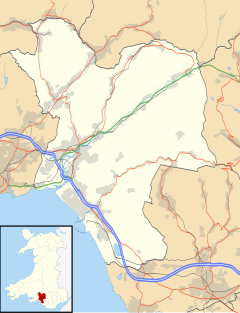 Cymmer Location within Neath Port Talbot | |
| Population | 2,825 (2011 census)[1] |
| OS grid reference | SS860961 |
| Community |
|
| Principal area | |
| Preserved county | |
| Country | Wales |
| Sovereign state | United Kingdom |
| Post town | PORT TALBOT |
| Postcode district | SA13 |
| Dialling code | 01639 |
| Police | South Wales |
| Fire | Mid and West Wales |
| Ambulance | Welsh |
| UK Parliament | |
| Senedd Cymru – Welsh Parliament | |
| Councillors |
|
Cymmer (Welsh: Cymer) is a small village in the community of Cymer and Glyncorrwg, in Neath Port Talbot in Wales, set on a hillside in the Afan Valley near the confluence of the River Afan and the River Corrwg. In 2001, Cymmer had a population of 2,883.[2]
YouTube Encyclopedic
-
1/2Views:4291 643
-
Investiture 1969 street party Cymmer
-
A tribute to our wonderful school cook Sheena.
Transcription
Description
Cymmer can also be spelled "Cymer", with "Cymmer" being the English-language version, and "Cymer" the Welsh language one. The word "Cymmer" translates from Welsh into English as "joining place of two rivers", and it is here that the Afon Corrwg and the Afon Afan meet, to flow onward as the River Afan until entering the sea at Aberavon/Port Talbot.
The immediate area is set in a densely forested upland area with steep sided river valleys cut through by the Rivers Afan and Corrwg. Patches of open moorland exist to the north and south.
Social conditions
The Cymmer electoral ward was one of the top 10% most deprived wards in Wales according to the 2005 Welsh Index of Multiple Deprivation.[3]
Amenities
Local public houses include The Refreshment Rooms (the preserved Rhondda and Swansea Bay Railway station) and a working men's club called The Coronation Club. Local amenities include a library, a community swimming pool, a sports hall, primary school, a police station and fire station.
Government and politics
Cymmer is also the name of the electoral ward for the immediate area around the village. It elects a county councillor to Neath Port Talbot County Borough Council. The ward includes some or all of the villages of Cymmer, Abercregan, Duffryn and Croeserw in the parliamentary constituency of Aberavon. Cymmer is bounded by the wards of Resolven to the north; Glyncorrwg to the northeast; Gwynfi to the east; Blaengarw, Caerau and Maesteg West of Bridgend county borough to the south east; Bryn and Cwmavon to the southwest; and Pelenna to the west.[4]
In the 2008 local council elections, the electorate turnout was 48.23%. The results were:
| Candidate | Party | Votes | Status |
|---|---|---|---|
| Scott Jones | Labour | 594 | Labour gain |
| David Williams | Ratepayers | 463 |
Only one nomination was received for the 2012 Local Council Elections, from the sitting councillor Scott Jones. Jones continued to be the councillor of Cymmer without a contest.
In the 2017 local council elections, the results were:
| Candidate | Party | Votes | Status |
|---|---|---|---|
| Scott Jones | Labour | 673 | Labour hold |
| Jeff Jones | Independent | 370 |
In July 2018, Councillor Scott Jones resigned the Labour whip. He therefore now sits as an independent.
References
- ^ "Ward population 2011". Archived from the original on 12 April 2015. Retrieved 12 April 2015.
- ^ "ONS: Neighbourhood statistics". Archived from the original on 12 June 2011. Retrieved 5 May 2008.
- ^ http://new.wales.gov.uk/docrepos/40382/40382313/statistics/wimd-2005/4038211011/wimd2005-analysis-pt4-r1-e.pdf?lang=en[permanent dead link]
- ^ "Election Maps". Ordnance Survey. Retrieved 6 September 2018.
External links
Electoral wards of Neath Port Talbot county borough | |
|---|---|
| Aberavon | |
| Neath | |
| International | |
|---|---|
| National | |
| Geographic | |